On Sunday there were no bus services and so Anthony kindly took us back to Lower Exbury where we finished last night. The day cloudy but not too dull (unlike our walk).
Unfortunately the walk into Beaulieu was to be entirely along the road. Being a dry Sunday morning the road was being used by lots of cyclists. We enjoyed seeing a small herd of donkeys; a change from the usual New Forest Ponies. (and yes we did take quite a lot of photos).
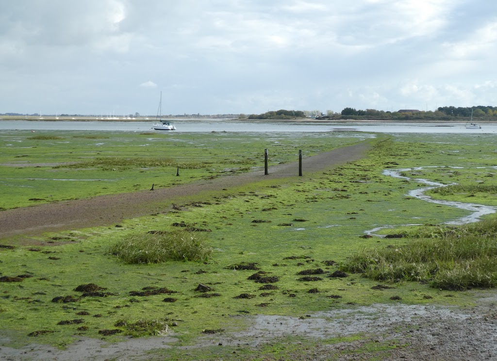
We had 4.5 miles of road walking to reach Beaulieu. In this area the land is all owned by estates and wealthy landowners who do not want the public going anywhere near “their” bit of coast. In effect, we did not see the coast at all on this day’s walk and only saw the water of the Beaulieu Estuary briefly at Beaulieu and at Buckler’s Hard.
Beaulieu seemed a bit shut down but it was probably just that we were too early for any cafés to be open in genteel Hampshire.
Beaulieu
The footpath from Beaulieu to Buckler’s Hard was busy with walkers. At Buckler’s Hard we stopped for coffee and a bun from the coffee stand before heading on to the roads once more.
The Duke’s Bath House
Cottages at Buckler’s Hard
Buckler’s Hard
The roads were again busy with cyclists but we were either in woodland or between hedges and so we had few views, least of all of the sea. After much road, we turned on to some footpaths through woodland. As ever, it was a long time before we could find anywhere suitable for sitting down and eating our lunch but eventually we found a couple of logs and sat admiring the huge fir cones on the tree across the path; three of them found their way into Jill’s rucksack.
Now we only had a couple of miles to go to Lymington. We passed the Burrard Neale Monument. Burrard Neal is a son of Lymington and eventually became an Admiral. He had an illustrious career even if most us have never heard of him.
The Burrard Neale Monument
As we walked on Jill spotted a mouse run across the path.
The River Lym
At Lymington we caught a train to Southampton and returned to Botley.
Anthony dropped us back at Netley to resume our walk. We were planning to catch the first ferry across Southampton Water to Hythe which is at 10.00 on a Saturday. We had about four miles to walk to the ferry to Hythe and an hour and a half to do them. We peered through the gates to Netley Abbey but couldn’t go in as it wasn’t yet open.
Netley Abbey
The walking was mainly along firm paths and so we made good time. We came to the River Itchen and climbed the steps of the bridge on to the roadway where there is a pedestrian walkway. The concrete bridge is unexciting but provides good views down the Itchen. Once in Southampton we made our way to the Town Quay and the ferry terminus.
From the Itchen Bridge
How ugly a car transporter ship can be
Various views as we walked into Southampton
An old Red Funnel Isle of Wight Ferry…
…and a modern one
A distant view of Netley Castle from across Southampton Water
We queued with some cyclists who were also getting the first ferry of the day. Our tickets probably included the ride up the pier on the Hythe Pier Railway which is about half a mile long but we walked along the pier into Hythe village. The pier railway dates from 1909 and remains the only narrow gauge railway in commercial use in England.
We might have stopped for coffee if the café had not been so full. Most of the rest of the morning was spent walking down the road until we came to Fawley. The huge refinery that was so obvious from the other side of Southampton Water, we hardly noticed at all because it is so well screened by mature trees. At the quay at Fawley the high tide was at its maximum and a couple of benches on the quay were in the water.
The exceptionally high tide meant that these benches were inaccessible
The path continued past the old power station at Fawley which is now being used as an installation terminal for offshore wind generators. It is maintained very securely especially getting over the swing bridge.
The ship Blade Runner Two, turbine blade in the background.
Crossing the swingbridge at Fawley
The path along to Calshott was only just emerging from the high tide and so was very water-laden.
The path had just emerged from the tide.
Air bubbled up from the shingle beneath the water.
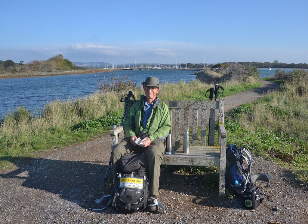
At Calshott we sat to eat our lunch on the step of a shuttered beach hut (having passed only one, already occupied, bench since we first thought about stopping for lunch well over an hour before).
The next section from Calshott to Lepe had a question mark over it. My brother had asked a friend about it who said it was possible to walk the beach but there is no path or right of way. Whilst eating our lunch, a young(ish) woman stopped to talk having seen the “Justcoasting” sign on my rucksack. She was local and swam at Calshott; she said her job involved work around the coast though didn’t say exactly what that was. We took the opportunity to ask her about the possibility of beach walking through to Lepe. She explained that it was quite possible to walk through and she had done so, though the land above the beach was all private and access along the shore was was “permissive”. She pointed out one or two significant land marks such as the point at which access is further restricted by a solid groyne which would need scaling or, at low tide, walking round.
After our chat we finished lunch and set off. We decided to try the beach route since the alternative was a tedious road walk. Initially we balanced our way along the top rail of the wooden sea wall and when that was too overgrown, we walked on the upper part of the beach and hurdled the low groynes which were regularly placed along the beach.
We walked on the top of the sea defences…
… until it was too overgrown.
Then we came to a stretch where the beach was overgrown with trees and other vegetation. The tide, though falling, was still in too far to walk around it and so, as Jill decided to take off her rucksack and crawl through, I had no choice but to follow.
Not much further along we came to the rather solid breakwater we had been warned about, with a sign on it suggesting that walkers might not be welcome and that the beach was an SSSI. At the top end of the breakwater, the final post was very close to the cliff face and had barbed wire wrapped around it to make getting past it almost impossible. The option of climbing over the top was unappealing given it involved a long jump down or trying to land on the top of a narrow plank. Once over, we wouldn’t be able to return if our path was impassable. The final option was to wade out around the end of the breakwater but, at almost high tide, that was clearly not sensible. Keen to avoid retracing our steps and having to repeat the beach crawl, Jill found that by removing her rucksack, she could just squeeze round between the barb-wired post and the cliff face. Yet again, I followed suit getting through without damage or injury.
The groyne was a bit high for climbing over.
But we squeezed past the top post.
Wading around the groyne was not an option.
Then we headed along the beach “hurdling” the breakwaters as we went.
Safely over the big groyne we continued to hurdle the little groynes
There were no more significant obstacles until we came to the end. There we found a barbed-wire fence and a solid breakwater but on this occasion it did not matter if we could not get back over and so we scaled the breakwater and were then in the Lepe Country Park. The country park had many visitors and they were no doubt entertained by watching us break in.
Looking back along the beach as we approached the barbed wire fence .
Beach goers bemused by us “breaking in”
The Solent Inshore Rescue boat was returning to it summer shore station at Lepe.
Lepe Lighthouse
From there we followed along the coast path towards Lower Exbury which was also tidal but by now the tide was well on its way out.
Initially there was a boardwalk from Lepe.
It then became a tidal path.
Shortly after Inchmerry House, Anthony picked us up and took us back to Botley.
We caught the train from Botley to Portsmouth Harbour and then got the ferry to Gosport which take just a few minutes to cross the mouth of Portsmouth Harbour. There is always lots to look at in Portsmouth Harbour including our newest aircraft carriers and the HMS Warrior, the first iron-hulled armoured warship with a steam engine.
Tha Navy’s new aircraft carriers
HMS Warrior
The Spinnaker
Portsmouth Harbour vista
We walked alongside Haslar Marina and across the bridge over Haslar Lake. The road then runs between the solid walls of HMS Haslar and Haslar Hospital on the other side of the road.
We crossed the golf course to reach Fort Gilkicker which was rather unimpressive. A woman stopped to chat about our walk and being a Scot questioned whether Berwick-upon-Tweed is really in England because its football team plays in the Scottish League. We followed along the stony coast of Gosport Beach to to Brown Down Base. This is relatively small firing range there were no red flags flying and the gate was open. A local dog walker reassured us that there was a good track through the range which was much easier than walking along the beach. We were enjoying our walk and were a little surprised when we turned a corner and came upon a bunch of armed soldiers. They were having firing practice within a smaller compound right by the track.
Near Hillhead
At Hillhead we had to divert inland off the beach due to a combination of high tide and housing coming down to the beach.
We crossed the bridge at Titchford Haven and walked along the mixed shingle bank all the way to the River Hamble. This was a pleasant walk on a sunny day with good views.
We fell foul of the “Sea Breezes Holiday Park”. The coast path here is closed due to erosion but we thought we could get through the holiday park because residents had made a path into it from the cliff. In fact we walked to the other side but it was too well fenced to get out and so we had to find our way to the main entrance. Fortunately it was no further than walking the diverted route but annoying all the same.
Walking up the side of Southampton Water
The River Hamble
Across Southampton Water to Fawley.
As you enter the Hamble there is a long pier extending from the Warsash Maritime School which has a training rig at the end of it.
The Maritime School’s Training rig
Fortunately the Warsash ferry across the River Hamble operates the year round. All the ferry companies craft are painted bright pink and it runs “on demand”. It was a beautiful, warm afternoon and so we stopped for ice creams at Hamble thinking that these might be our last ice-creams of the year.
The Warsash Ferry
I was interested to see this warning sign by the oil terminal at Hamble-le-Rice but I wondered exactly what it means.
Does it mean that there are two cables under the water? In which case it is unclear exactly where they are, or do they mean no anchoring for 1 cable either side of that point? I am not sure how many people, even mariners, know what length a cable is. It is a quaint old unit (variably defined but approximates to 1/10 of a nautical mile or about 100 fathoms)) which must have gone out of standard use years ago.
Walking up from the oil terminal
We started walking up Southampton water, once more initially along the beach but after a short while we had to move up to the path through the Royal Victoria Park. This was the site of the Royal Victoria Military Hospital and old photographs reveal what a huge magnificent building this was. Even now, what remains provides a flavour of how it must have been. It is well worth Googling it to see old pictures showing how huge it was.
The last vestige of the Royal Victoria Military Hospital
We came into Netley and once more Anthony picked us up for another evening of good food and conversation.
From Botley, my brother drove us to Havant to to resume our walk. It was yet another bright, sunny morning with a quite a nip in the air. We headed back down to Langstone Harbour. It all looked beautiful with the tide right in and the sun right out.
We headed around the little peninsula that is Farlington Marshes where there were lots of birds and nearly as many birdwatchers and dog walkers.
Walking around Farlington Marshes
A knot of Knots
Once round the marsh there was a short section where we were squeezed between the A27 and the harbour until we came to Portsea Bridge. Portsmouth is, of course, on Portsea Island and so arguably should not be part of our walk. However, socially and politically, the island is very much part of the mainland. More importantly I have an elderly aunt who lives in Southsea and we thought it would be nice to call in on her as part of our walk. I did phone her the day before so it would not be a shock when we turned up. She just needed to make sure she would have time to cycle back from badminton before we arrived. Not bad for someone in her eighties.
Portsea Bridge
Having crossed Portsea Bridge on to the island, unfortunately the next section of path was closed for essential work (which begs the question when they ever do non-essential work). We followed the cycle path alongside the road until we could get back on to the harbour wall.
People’s Memorial to the Armed Services
Peoples’s Memorial Gardens overlooking Langstone Harbour
We had found a bench and had coffee in the sunshine just before we got to the Memorial Gardens where we would have been spoilt for choice for a bench to sit on. It has become a remarkably regular feature of our walk that we will pass several attractively-sited benches when we most need to press on and then struggle to find anywhere to sit comfortably for a coffee break or to eat our lunch. Often we have resorted to perching on our sit mats on the edge of an embankment or fashioning a hollow on a shingle bank when we realised the bench we thought we could see turned out to be a sign or a wheelie bin.
As we came to Eastney I had expected we would need to come inland to get around Eastney Lake, which is not a lake but just an extension of Langstone Harbour. Jill thought that we might be able to get around the foreshore because a narrow strip of sand was exposed even though it was high tide. It was a nice idea but we could not have got round except by getting wet feet or removing shoes and socks and there was too much broken glass to risk that.
Trying to walk the edge of Eastney Lake
We retraced our steps and went round by road until we reached the beach at Eastney. Now we had a simple stroll along the promenade. The beach, which is shingle is not really walkable except by fitness fanatics.
Marine Memorial – Southsea
We sat on the edge of the prom (having walked past numerous benches earlier) to have a slightly early lunch. We had made today’s walk a few miles shorter than usual so we would have time to spend a couple of hours with my aunt. It was really good to have time off and sit in comfort and have a cup of tea and cake. I was delighted that my cousin Nigel, who lives nearby, called in to say “Hello”.
Jill, Jenny & Cliff
After leaving Southsea we had three miles to get to the station at Portsmouth Harbour. It was a pleasant walk with some warmth in the late afternoon sunshine. There was a train at 16:59 and we were on a tight schedule and so we did nothing more than take a few photos of the sights as we rushed for the station.
The Isle of Wight Ferry
The Lighthouse – Southsea Castle
The War Memorial – Southsea
The Spinnaker
Spitbank Fort in the Solent
Royal Garrison Church. Portsmouth
Unfortunately a footpath closure delayed us and the station entrance being a long way round near the ferry terminal meant that we made it on to the platform just as the train pulled out and then had an hour to wait for the next one.
We had a short bus ride from outside the Premier Inn Chichester to Bosham and were back en route once more.
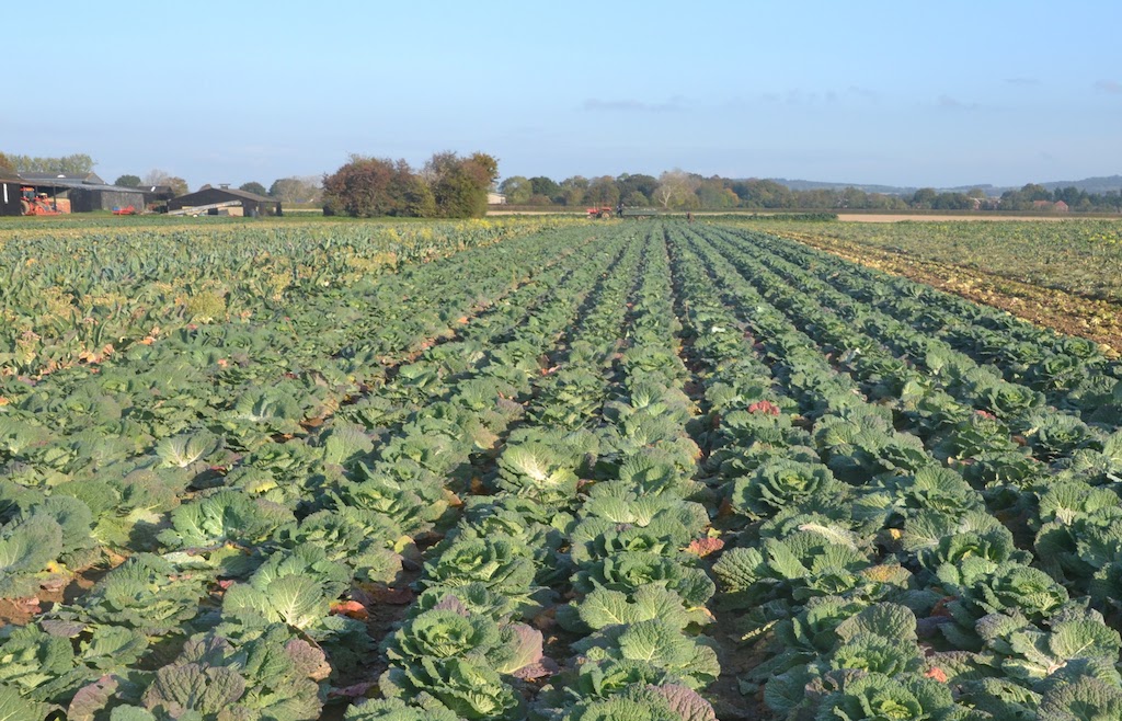
We had a short walk along the main road before turning down the side of another peninsula projecting into Chichester Harbour, this time Cobnor. The peninsula is similar to Bosham but narrower. At Eastfield Farm there was field of winter vegetables growing. Unlike the vast monoculture fields of the Lincolnshire fens this was mixed field and it was interesting to see just how many varieties they were growing – and there are several more we did not photograph.
Looking across to Old Bosham, the harbour was now full of water as high tide was due in one hour.
Bosham Channel now full of water
Coffee at Cobnor Point
On the way to Cobnor Point the path follows the top of a seawall between the harbour and a connected lagoon.
The sea wall to Cobnor Point
From Cobnor Point we walked up the side of Thorney Channel and around the top. A short way beyond Marsh Farm is the remains of an old causway that once went across to the bay to where Prinsted Marina now is. The timbers that formed the causeway are well preserved and Google Satellite pictures shows the old causeway quite clearly.
The old causeway to Thorney Island
It was nice sunny day and we were enjoying our walk and so it was only when we reached the Prinsted Marina that I realised we should have gone straight ahead at Prinsted. We had decided that we would not walk around Thorney Island because it is an island even if it has three bridges connecting it to the mainland. It is also an MOD restricted area. As we approached Emsworth, we came through a marina complete with boating chalets build on stilts but on dry land. They looked rather like shipping containers. Then we walked up a narrow path which divides the Slipper Mill pond into two longitudinally. We were just getting to the end of it having passed a few people on the way when a self-important woman remonstrated with us that it was a “one-way” path because of Covid and we were going the wrong way. I avoided arguing with her. We walked up into the village, bought some things for lunch and then followed the path round another mill pond until we found a suitable bench for lunch.
Emswoth
The path around the mill pond at Emsworth
After lunch we continued round the edge of the harbour until we came to Langstone Bridge.
Langstone Bridge
The old causway to Langstone Island.
Langstone (the nice bit)
The old part of the village was quite attractive, clustered around the causeway and bridge.
Then we had a short walk around the top of Langstone Harbour before turning inland to Brockhampton Station which is on a direct line back to Chichester. We walked back to the car and drove to Botley where my brother and his wife live. They were going to host us for the rest of this section of the walk. There is a good bus and train network in this area and my brother had kindly offered to give us some lifts when we couldn’t use public transport.
This morning we got the bus from just outside the Premier Inn to Bracklesham and we were walking at 8:30. The wind and rain of yesterday had all settled. Today we would be starting the long walk around Chichester Harbour.
High tide was due soon after 9:00 and so, when we looked at the beach, there was no sandy margin to walk on – just the shingle bank behind a row of houses. The shingle was not an easy walk and was punctuated by regular groynes so we followed the road behind the houses until shore was more walkable. Approaching West Wittering, we managed to walk the wide sand beach for a short while.
At West Wittering the beach changes quite dramatically from being a steeply shelving, shingle beach to a flat, sandy beach. West Wittering is definitely the posher of the Witterings, with a seemingly unending supply of expensive properties but generally we were able to get along the shore line.
Between West Wittering and Itchenor
At Itchenor we stopped for coffee and panninis outside under a canvas awning which was fortunate because the only shower of the day happened as we were under cover.
The ferry from Itchenor to Bosham only operates during summer months and so we knew we would have to walk almost into Chichester to get round the harbour (an extra nine miles). The walk was quite pleasant. We followed the shore through the marinas and across the lock gates at Salterns. This is where the Chichester Ship Canal (now disused ) meets Chichester Harbour. Following this is a more impressive lock for the marina.
Very expensive boats
Birdham Lock
Birdham Lock
We could see that there was a shoreline path on the ground between Birdham and Dell Quay even though there was nothing marked on the map and a local lady told us we would be able to get along there with the tide as it was.
Dell Quay
At Fishbourne we finally reached the top of one of the arms of Chichester harbour. There was a big flock of swans grazing by Fishbourne. A walker we passed said she had counted at least 83 swans.
Swans at Fishbourne
We then started down the side of the Bosham “peninsula”. Initially this was through a nature reserve along a tidal path. Fortunately it was now approaching low tide and so it was quite walkable, if a little wet.
The ferry landing at Bosham Hoe
We then had to leave the shore and follow roads around Bosham Hoe, where there are a lot of very large houses with land right down to the shore line; the shore itself would be too marshy to walk the intertidal zone even if we could get to it. At the ferry landing stage we reached water once more and we stopped for a late lunch at about 14:15 and looked across the narrow channel to Itchenor where we had had coffee nine miles earlier. It had taken us 3 hours to walk round from the other side of the ferry.
The tidal path to Bosham
From the ferry landing stage round to Bosham is almost entirely a tidal path which was slippery and wet but otherwise quite interesting. Bosham is a pretty village around a projection of Chichester harbour. The ground around is flooded every high tide. There is an old right of way which crosses the little estuary which is an easy walk when the tide is out.
Bosham
The causeway at Bosham
From Bosham there is a little more shoreline walking before we crossed farmland to get to Broadbridge and Bosham station to get the train to Chichester. We had a quick look at the centre of Chichester in the daylight for the first time and after showering went to Cote Brasserie for dinner.
We got the train from Chichester and walked back to the old pier where we had finished yesterday.
It felt distinctly fresh with a steady breeze from the west raising the sea into white horses everywhere. We walked out of Bognor along the promenade. This gave way to a stony track but soon we had to divert through Aldwick because a private estate blocked the way along the beach. Where we turned to get back to the beach there was an interesting information board with an image of a medieval map of the area. It was a startling demonstration of just how much of the coast here has been lost to the sea over the previous five centuries or so.
Once back on the beach again we had a mile or two along the shingle though, because the tide had recently turned, there was a narrow strip of wet sand which made the walking a bit easier. At the end of Pagham beach we turned inland to walk around Pagham Harbour which is an RSPB reserve. There were a good range of birds to see albeit in relatively small numbers.
The mouth of Pagham Harbour
Much of the walk around Pagham Harbour was tidal
After that five mile diversion, we got back to the shingle sea bank at Church Norton and then followed it all the way to Selsey.
On the shingle spit at Church Norton
We had hoped to find a café but there were none on or near the promenade. We continued around the Bill (which is a bit disappointing).
The tip of Selsey Bill
Then we followed along the shore to West Sand, a rather large holiday camp and caravan site. We had still not stopped for lunch and the weather was becoming more overcast with rain threatening. At West Sand we had to turn inland and walk around the Medmerry Nature reserve. This salt marsh reserve has been formed as compensation for loss of habitat elsewhere. The breach created in the sea wall has three components and there are dire warnings not to attempt to cross the breach. We had not expected to be able to cross the breaches but I had planned to walk along the replacement sea wall around the reserve.
Looking out to the breaches in the sea defences
We met a couple who were some years our junior but were keen walkers and interested to learn about our coast walk. Being local they able to reassure us that we would be able to get around the Medmerry Reserve and that the paths were good even though they do not appear as rights of way on OS maps.
Unfortunately the sea wall is, in part, securely closed off and at this point there was a substantial bench and at last we stopped and had some coffee and flapjack (lunch just never happened). From there, there is a good path which is not on the OS maps, skirting round to rejoin the sea wall beyond Greenwood Farm. We continued along the sea wall but were disappointed to see signs declaring the footpath was closed between 9am and 5pm for water vole preservation work. There didn’t seem to be anyone around preserving water voles or doing anything else and so we pressed on regardless until we came to the sea “proper” at Bracklesham Bay.
The beach at Bracklesham
By now it was raining and blowing in quite hard off the sea. The beach here is a high shingle bank which was going to be very difficult walking and so we followed a track along the seaward side of the shingle that provided a little shelter from the wind. As we approached Bracklesham I checked on the bus times and I realised that a bus was due quite soon. Really we could not walk any faster and as we turned inland from the beach to go to the bus stop, I saw the bus pulling away. Having got to bus stop, the timetable showed it would be an hour before the next bus; to our surprise another bus appeared but that turned out to be a school bus. It was raining hard and we were chilling off now we had stopped walking. Checking on Google, I realised that the bus route was a loop out and back from Chichester and that being at almost the farthest point from Chichester we could get the next bus in the opposite direction and be in Chichester in a little over half an hour.
Back at the hotel we warmed up and dried off and ate at Bill’s restaurant in Chichester, our third meal at a Bill’s this trip. We had used the Bill’s in Eastbourne, then ate at the original Bill’s in Lewes so we thought we’d go for the triple. A varied menu and good food, reasonably priced and significantly better than pub food.
We drove to Worthing and left the car parked near the station. After half a mile we were back on the sea front and weaving in and out the runners and cyclists once more.
Worthing Pier
It was bright, clear and quite cool. We were mostly on tarmac or concrete but shortly before Rustington we stopped for coffee in the sunshine. It was not long before we could see enough clear sand to make it worth walking along the water’s edge.
We managed to walk all the way to the harbour at Littlehampton on the damp sand. Occasionally we had to time the waves to get around the end of a groyne; the alternative being to duck under the rail of the groyne or to climb over it. Jill called it beach hurdles.
We were becoming familiar with how remarkably “tame” turnstones are – we saw several running back and forth along the breakwaters. Littlehampton is a pleasant seaside town with lots of cafés on the east side of the harbour.
Harbour mouth Littlehampton
Littlehampton Harbour
Unfortunately it was a bit too early for a lunch break and so we continued across the footbridge to the west side of the harbour and down to West Beach. The beach this side had far fewer beach goers and once more we walked on the sand as far as we could go.
The beach near Atherington
At Atherington we found it easier to walk the footpath than to climb over the groynes and broken sea defences.
We passed one house which backed onto the coast path who clearly wished to remain very private but had installed a shelf on their very substantial fence so that their dogs could see the view and bark at the passers-by
As we came through Elmer we were on a concrete sea wall but at Middleton-on-Sea the path came to an end and we took an inland diversion through Middleton and got back to the coast just a few hundred yards further along.
From there it was simple walk along the promenade to Bognor Regis from where we got the train to Worthing, retrieved the car and drove to Chichester Premier Inn.
We have grown to quite like Premier Inns. For walkers like us they have the huge advantage that you can pretty much arrive at any time and leave as early as you choose. They serve breakfast from 6:30 and so you can still be off very early for a full day’s walk. Since we don’t want a cooked breakfast, we usually buy a pint of milk the night before and each have a bowl of granola out of plastic bowls that we take with us. Premier Inns are very good value, and we usually manage to get rooms for between £32 and £45 a night for the pair of us. For that we have a comfortable bed and a bath and shower with heating/aircon. A campsite can easily cost £10 per person and possibly extra for showers etc. There are other inexpensive hotel chains but we have found that Travel Lodges are more basic and a little bit jaded compared with Premier Inns. Holiday Inns and Ibis Hotels are fine but there are fewer of them around the country.
We got a train to Newhaven, then a bus to Peacehaven and we were walking shortly before 9:00. Originally we were planning to walk to Shoreham but having three or so miles in hand pushing on to Lancing or Worthing was a possibility and would make it easier to get back to the next day.
We walked to the cliff top at Peacehaven and followed the broad grassy path between the houses and the cliff edge. It was quite a chilly morning; we needed our gloves. There is a promenade along the base of the cliffs at Peacehaven but it only goes a short distance before one has to climb back up to the clifftop path.
Telscombe Cliffs
The promenade from Ovingdean is then continuous all the way to Brighton and beyond. Shortly after starting from Peacehaven we crossed the Greenwich Meridian and therefore the start of the Greenwich Meridian Trail. It is not quite on the true Greenwich Meridian and it has been moved 3Oft north from its original position because of cliff erosion.
Meridian Monument (courtesy of Peacehaven Town Council)
At Ovingdean we took to the Promenade which was very busy with runners, cyclists and people out for a social stroll. We weaved in and out around the the various groups.
Approaching Brighton (at Rottingdean to be precise) Jill noticed a chalked up graffiti for Black Lives Matter which had been amended with a single “O” to read “Black Olives Matter”. How very Brighton.
At Black Rock we came to the marina where there is a huge development of smart apartments along the harbour-side mostly with private moorings.
At Brighton Beach we walked alongside the Volks Electric Railway. This was the oldest working electric railway in the world and still runs providing a service to tourists. There were two earlier electric railways in Germany but neither of these survive.
Brighton prom was full of people keeping fit. Apart from the runners and cyclists there were at least two beach volley ball sessions going on, several outdoor gym sessions and all manner of exercise classes on the greens. There is, appropriately, inspiration to all the runners in the form of a statue of Steve Ovett who was born and bred in Brighton, though I am not sure it is a very good likeness.
If it wasn’t written on the plinth I would never have guessed
Brighton attractions now and then
The British Airways i360 is a viewing platform which looks impressive though we had no time to take a ride. Unfortunately it has failed to attract as many visitors as was hoped. I still like the appearance of the old West Pier.
We stopped for a coffee in Brighton before continuing along the prom. Brighton became Hove and then we were walking along the spit that forms Shoreham Harbour which is just industrialised with a stoney beach on the south.
The beach Portslade-by-Sea
We took a photo of the Power Station and sent it to Emily as another round in the game “Name that Power Station”. Then we crossed the lock gates to the landward side. The walk into Shoreham was no more interesting being along a road with industrial units and various out-of-town stores.
Shoreham Harbour
Crossing the lock gates Shoreham
The centre of Shoreham was quite attractive and all the more so because it had several cafés, one of which we used for a bite of late lunch. Then we crossed the bridge over the River Adur which feeds into Shoreham Harbour, and turned west to follow the paths between the coast and the Widewater Lagoon. As we walked the sun, which had been lost to us since mid-morning, re-emerged and the afternoon warmed up. We followed the grassy path at the top of the shingle bank and shortly this became a formal promenade which we followed all the way to Worthing. Having almost reached the pier at Worthing it seemed a good point at which to get a bus back to Brighton and a train to Lewes.
Eating out on Saturday in Lewes was not easy, with Covid restrictions many restaurants were already booked as fully as they could be but fortunately an Indian restaurant had a cancellation that we could make use of.
We awoke to a clear, dry morning and having checked out of the hotel were soon walking along the promenade with the cliffs of the South Downs looking brilliant white in the morning sun.
At the end of the prom we followed the road a short distance to where several long distance paths start; the South Downs Way, the Vanguard Way and the Weald Way.
Three long distance paths start from Eastbourne
We took the path which followed the top of the chalk cliffs most closely but all the paths finish up at Beachy Head anyway. The chalk downs turf was well drained and short and so we were going quite fast despite the climbs. There were plenty other walkers and runners enjoying the spectacular scenery.
Beachy Head Lighthouse
Belle Tout Lighthouse and the Seven Sisters
Belle Tout Lighthouse and an Edge of Cliff
We came to the Birling Gap and paused there at the National Trust Café for a coffee and we enjoyed watching the sparrows that Jill enticed on to our table with some crumbs from her shortbread.
Then it was up over the Seven Sisters. I had not realised that each one is individually named but none of them have girls names which seems odd. (They are Went Hill, Bailey’s Hill, Flat Hill, Flagstaff, Brass Point, Rough Brow, Short Brow and Haven Brow.
The Seven Sisters
As we came over the last Sister, we could see down to Cuckmere Haven and the tide was fully out. We realised that there was the potential to paddle through the Cuckmere River at the beach where the river narrows and becomes shallow when the tide is out.
The tide was out at Cuckmere Haven
We climbed down the steep chalk path on to the beach and walked the crest of the shingle bank to the river.
Cuckmere Haven
The steep chalk descent to Cuckmere Haven
We watched as a couple crossed the river towards us; it was only knee deep and so we decided to take shoes and socks off and ford the river at its narrowest point. The only problem was the very stony river bed but we had our walking poles to help us. Crossing there saved us having to walk up the Cuckmere River to Exceat to cross the river at the bridge – a distance of about 2.5 miles.
Crossing the River CuckmereCuckmere Haven and the Seven Sisters
We returned to the chalk downs once more and walked over to Seaford where we reached the start of the promenade and sat on the Shoal Bench for lunch. The bench is a long serpentine-shaped bench made up of fish-shaped back rests and fish inscribed blocks of wood for the seat. There are other fish-themed benches as well.
From Seaford there is a promenade most of the way to Newhaven. Where it runs out there is an old mill track which brought us into Newhaven at about 15:00.
Newhaven Harbour
Scrap metal being loaded for who knows where?
We liked this
Having saved some miles by fording the river, we had reached the end of today’s walk much earlier than our usual finishing time. Jill was keen to capitalise on this and so we decided to press on beyond Newhaven and set off for Peacehaven.
Looking over Newhaven Harbour
The sky in the west was now very heavy and the wind had got up almost as strongly as yesterday. As we arrived at Peacehaven at 16:00 I checked with Google and it seemed likely there was a bus due at about 16:15 so we headed inland to find the bus stop. As we got to the bus shelter the heavens opened and the rain lashed down. To our delight there was a bus due in four minutes and, even better, an express bus to Eastbourne in five minutes.
The promenade at Peacehaven
How fortunate was that?
On the top deck of the bus, as the rain lashed down, we could see much of the route we had walked. Back in Eastbourne we shopped for one to two things before collecting the car and driving to Lewes which, though inland, is very handy for trains along the South Coast.