Day 300 – Peterhead to Collieston 17.6 miles 2411′ ascent

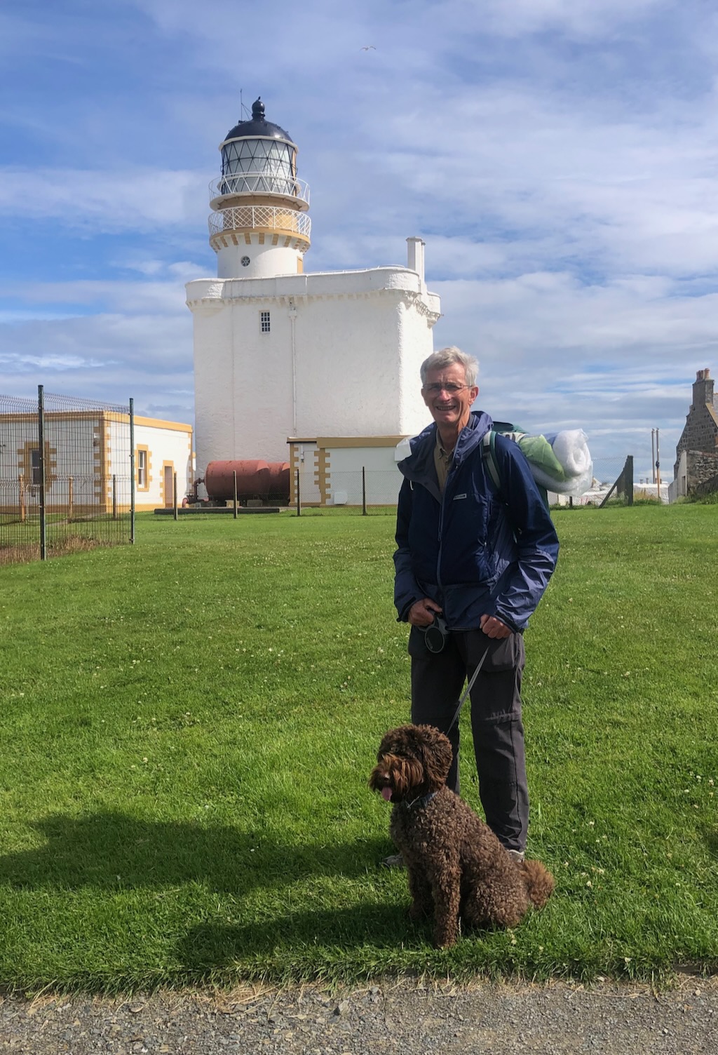
Wednesday 19th July 2023

We took a car down to Collieston then returned to Peterhead to resume. We walked past the marina and then up the embankment to where Peterhead Prison is located. There is some rough ground around the prison and it was very overgrown but a rudimentary path led to the prison fence (the prisoners don’t get out enough) and we walked along the concrete foot of the fence and then down to the B road that leaves South Bay Harbour.

We followed the fence along the concrete foundation of the prison fence
Walking past the Young Offenders Institution attached to the prison

After half a mile there is a path off on the left to Sandford Bay, though we might not have found it. From a distance we saw a car pull into a little entrance, a man got out followed by a dog and they disappeared. When we reached the entrance there was just the car and a pair of wrought iron gates apparently locked and no sign of a path. Jill then noticed that the lock was only on one of the gates, the other yielded to her attempt to open it. Through the gate, a drive way leads to a deserted house but a little path branches off to the left and descends to the beach where one man and his dog were not mowing a meadow but playing on the foreshore.

Sandford Bay with Peterhead Power Station in the distance

A good path leads across Sandford Bay before climbing steeply to Sandford Lodge, another deserted house. The path passes through the wall of its garden and out the other side where we were faced with Peterhead Power Station. We sent Emily a quick “Name that power station” photo. It’s a silly game we play (for those who don’t know, Emily is Energy Editor at The Times and so she knows about these things). We haven’t been past a proper functioning power station for months, the last one was Dounreay but that has been decommissioned.

Peterhead Power Station
Looking back to the Young Offenders Unit – there must be a lot of bad boys in Scotland

We now came to Boddam, probably a former fishing village. The old part is quite attractive.

The harbour at Bodam
Buchan Ness Lighthouse stands on a tidal island connected to the mainland with a bridge
Looking across Boddam Harbour

We walked past The Red Shed which, until March 31st this year, was the Boddam Post Office. Sadly this closed on the resignation of the postmaster and though residents have been told that the Post Office is “currently investigating the options available” that will enable them to reinstate the service, they have warned any potential options must be “sustainable” for the future which doesn’t sound very promising.

The Red Shed is a gift shop and former Post Office.
Buchan Ness and lighthouse

There has been quite a lot of building behind the old village including a large Sea Cadet training facility. Leaving Boddam, a grassy path suddenly becomes an engineered gravel path that leads around the cliff tops before turning up to the road. We branched off along the route of an old railway and then down to the cliff tops once more at Long Haven. For the rest of the day we would be walking cliff tops except for a mile and a half of beach.

At the Longhaven Nature Reserve someone had been using a strimmer

At Longhaven we entered the Nature Reserve where there was a good path. Above Long Haven beach the path has been closed because it has fallen away.

Looking back to where the path had been closed.

Oddly there was no notice advising of the alternative route which was to cross back to the former railway line and walk a few hundred yards before crossing back into the RSPB reserve and continuing around the cliffs. We simply forged a path along the upper side of the fence until just before the diversion ended. There were lots of seabirds and a rarely-spotted strimmer-man keeping the paths free of vegetation. We thanked him for his efforts.

Miekle Dumeath
Harebells
A grassy path and a bank of wild flowers
Excellent steps at Heathery Haven
Not such a subtle appearance from the other side.
Little Dumeath
It was good to be walking along a more interesting cliff path again

It was quite comfortable walking on a clear path and we were enjoying the views  of the cliffs and the sea stacks and quite a few natural arches. After struggling with difficult and non-existent paths around so much of Scotland it was quite a novelty to have way-marked paths for the Angus Coast Path and to have well-maintained infrastructure. We are definitely getting back into civilisation.

This looked like an interesting area to explore and perhaps stop for coffee but it was closed off due to erosion
Memorial to two climbers, James Paterson and Alexander Hamilton who were killed climbing the cliffs here.

Just after The Stein there is a small promontory where we stopped for lunch by a memorial to a pair of climbers who died climbing the cliffs here in 1967. I have not been able to find out any more about the tragedy.

Nearby is an old quarry with a warning notice not to use the bridge which we grudgingly complied with.

But looking back it was clearly a bridge not worth taking a risk with.

The coast here just keeps on giving. There is an abundance of geos, stacks and natural arches. There are too many to record them all or for any one to want to look at all the photos.

The heather was beginning to add colour along the clifftops though the seathrift was now over
I startled a roe deer along the path
The path followed the cliff tops quite close to the edge giving good views onto the bays below
We could see a fisherman checking his lobster pots
North Haven once had a track down the beach. It is still there but quite overgrown.
Kittiwakes nesting on the cliff

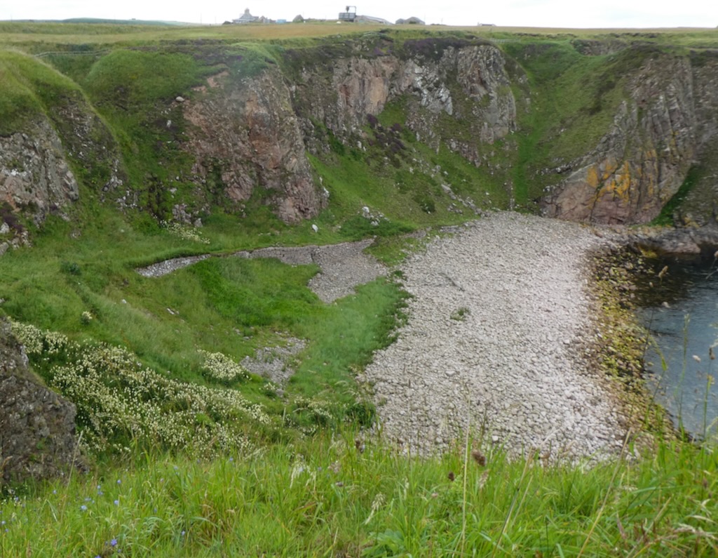
Bullers of Buchan sounds like a gents’ outfitters but is a huge, collapsed sea cave, quite an impressive sight and popular with tourists and birdwatchers. It gives its name to the local village.

Bullers of Buchan is a huge, collapsed sea cave.
There are a number of stacks and arches at Bullers of Buchan

Next on the horizon was Slains Castle a deserted structure on a headland. It was constructed in the 16th century and has been modified many times since. It is thought to be the inspiration for Bram Stoker’s Dracula. It was also used as a substitute for the Castle of Mey in the first series of the Crown.

Slains Castle in view
Slains Castle

We did not spend long there because we were a bit behind on our schedule. Fortunately the path from Slain Castle is a well-used track. We came into Port Erroll at about 1.30 and so we had made up a bit of time. Port Erroll has an attractive area overlooking the river where there are some benches where we settled in for our lunch. The bigger village of Cruden Bay sits a little inland from Port Erroll but gives its name to the bay we would walk around after lunch.

Port Erroll; a nice lunch stop.

After lunch we had a good eight miles to go which on the basis of the morning’s walk would be another three hours.

The bridge over Cruden Water

We set off across the footbridge over the Water of Cruden to Cruden Beach. This lovely beach was easy to walk; the sand was firm, the waves tiny and high tide was an hour away. All this was heartbreakingly marred by the the seabirds dead from avian flu washed up on the sand. Sadly there were even a few birds still alive just sitting on the beach waiting to die. So, so sad.

The beautiful beach was a cemetery for the poor birds dead from avian flu
Cruden Bay; a good beach walk.
What sort of fish is this ?
I think we can cope with that after all we have done

At the end of the beach a gate leads onto a path with a sign saying “Path to Whinneyfold”. This was very encouraging. The path was not quite as good as the paths we had been on in the morning but we could see the path and followed it the mile or so to the tiny village of Whinneyfold.

Sandy Haven (which is mainly stone) and Cruden bay beyond (sandy).

At Whinneyfold another sign indicated the path to Collieston. Once more I thought this was very encouraging. Our hopes were soon dashed as this soon became the most difficult path of the day, indeed the last several walking days.

There is a path in here somewhere
Cross with care

The path is definitely there and there are way-markers and some infrastructure by way dilapidated footbridges and some steps.

For the avoidance of doubt, the sign told us we had been on a footpath
Probably a safer bridge
Thistles, hogweed and nettles put up quite a resistance

The problem with the path is just it is underused and overgrown. We were forcing our way through long grass, thistles, hogweed and nettles.

In places the path is narrow and along a cliff edge with a huge drop; I will admit that, thanks to my double vision and varifocal glasses, I felt rather insecure. At one point the path came to a fence with a stile option along the cliffside of the fence or to the inland side of the fence. It wasn’t obvious which route to take and since the rest of the path has been on the seaward side of the fence, we took that choice. It was not the wrong choice but it was a little hair-raising, for me at least. At the end of this section it was clear there there was also a path of the other side of the fence probably because the path we followed may soon become unwalkable, and we could have taken either route.

No visible path but we could hang on to the fence
There really is a path here.

We were going very slowly. The path was was often obscured by the vegetation and so we were slipping off the side of the path at times or stepping into holes or simply tripping over the long vegetation. The views were also very good but we were rather distracted by the effort of following the path to appreciate them fully.

A clearer section of the path but it didn’t last long
Progress to Old Slains Castle was quite slow.

Four and a half miles since we left Cruden Bay, we came to the confusing “Old Castle” because the OS also calls it Slains Castle whose namesake, the New Slains Castle, we had passed in the morning .

All that remains of Old Slains Castle is the corner of a tower.
The path was hard on the legs but the view was easy on the eyes.

From here we had only just over a mile to go to Collieston and the path was marginally better.

We were approaching St Catherine’s Dub, the dark bay enclosed by cliffs at Collieston. The tradition that the St. Catherine, one of the ships of the Spanish Armada AD 1588, was wrecked in St. Catherine’s Dub was confirmed in 1855 when the minister raised one of the guns. It is 7’9″ long, of iron, and is at the manse of Slains where it has been mounted on a carriage. There are said to be more guns in the same pool.

Looking across St. Catherine’s Dub from above the car park at Collieston.
The sting in the tail – a very steep-stepped descent to the car park.

We reached the end at about 17:30 and we were both very tired.

Day 299 – Inverallochy to Peterhead 18.5 miles 630′ ascent

Tuesday 18th July 2023

We left one car at the car park above the Peterhead Marina and returned to Inverallochy to start walking.

After a short distance on the links above the beach, we were soon on the beach itself. We strode along the damp sand but diverted around the rocks at Corse Craig and then we were on the sandy beach once more.

Picking our way around the rocks at Corse Craig
Jill spotted this glove which reminded us of the fingers appearing from car boots that were popular years ago.
I think that this was formerly a harbour

We were walking on a rising tide with high tide at about 13.00.  Even though the sand was damp from the last high tide, it was quite soft in places and we struggled to find the firmest sand on which to walk.

A minor burn at South Cample zig-zags its way across the sand.
Cliff walking under the high cloud…
… and Jill walks under a clear blue sky. Photos less than two minutes apart but looking in opposite directions.

Only a mile or so after St Combs, the outflow from Loch Strathbeg joins the sea. Probably a bit unnecessarily, we headed inland to the footbridges that cross two burns. We could have just paddled across in our over-wellies because it was not very deep but Jill thought it might be just as quick to use the footbridges. She was concerned that pulling on wellies wouldn’t be quite as easy as usual; my back had been a bit stiff since spending the previous weekend picking all our gooseberries and blackcurrants and putting on and taking off wellies to cross the river yesterday hadn’t exactly helped its recovery, so we headed inland to the footbridges. On the map it looked like a simple detour but the indistinct path crossed through long, rough dune vegetation and in retrospect we both wished we had settled on wading across.

Heading across the dunes to the footbridges
Sea Rocket (edible)
The bridges are quite well concealed by the long vegetation.

We regained the sandy beach once more with Rattray Head our next landmark. Once again the sand was much less firm than we would like and we were sinking in an inch or more with every footstep which adds very considerably to the effort required. We found a nice, sand blasted log to sit on for our morning coffees.

Back to the water’s edge once more
An array of seaweed strands attached to pebbles
The sad toll of avian flu
We sat here for coffee; the bark had almost a leopard-skin appearance.

The lighthouse at Rattray Head is build on a man-made platform, a little way off the shore. There is a causeway to it shown on the map but it was completely underwater when we got there. Though the lighthouse was built over just three seasons, it took forty or fifty years to get the project underway; Trinity House, then responsible for lighthouses, declared a lighthouse unnecessary and had to be overruled by appeal to the Board of Trade. There are the old lighthouse cottages just inland but we did not see any sign of them as we rounded the head.

Rattray Head Lighthouse

We now had a three mile, sand walk from Rattray Head to the North Sea Gas Terminal at Fergus.

Stormy light over the bay south of Rattray Head
Sanderlings scurrying along the water’s edge
Flares at the Fergus Gas Terminal
Walking through the dunes to reach the fence around the gas terminal at St Fergus
Walking along the sea wall protecting the gas terminal.

As with other North Sea gas termini, St Fergus is protected by a double wire fence patrolled by armed police.

Just south of the gas terminal, the Annachie Burn enters the sea and, at high tide as it was, there was no choice but to walk across the dunes to the path that follows around the perimeter fence until we came to Annachie bridge. This old bridge looks as if it might not last much longer but I suspect it is much more robust than it appears. It is a proper stone arch bridge but with very low parapets. Over the years vegetation has taken a hold in the sand blown onto it and so there is just a narrow path walkable over the bridge.

Annachie Bridge
The rather overgrown Annachie Bridge
It looks lovely…
…but the sand was very soft

We had found the beach walking on the soft sand very tiring and so we followed a track that runs through the dunes parallel with the beach until we reached the road end from Fergus village. The map promised a carpark and picnic area and so I suggested to Jill that we should have some lunch there even though it was raining lightly.  We were both tired and in need of a sit down. The picnic area no longer has any benches or tables if indeed there ever were any. So we kept going.

Jill was reluctant to walk on the beach again and so we climbed to the top of the dunes where a path of sorts continues but it was very indistinct in places and finding a way up and down the soft dune sand through overhanging dune grass made for very slow progress. Looking down from our vantage point Jill spotted a constructed grit and sand path but at that point it seemed to be heading inland and so, having looked to see that it did not exist on the map, I suggested we continue on the path along the top of the dunes. This we did but it became increasingly difficult and, frustratingly, the track spotted by Jill, which was now running parallel to us, was separated from us by a barbed wire fence. We followed the fence which just ended, serving no useful purpose, and then joined the track.

By good fortune, there was a bench there and so we stopped for a quick bite of lunch and enjoyed the rain. Lunch done, we continued along the track which I began to think must be part of a new coast path into Peterhead. That was not the case because 1½ miles further on it turned back on itself towards the sea and ended abruptly at the top of the dunes. It was clearly no use as a wheelchair path or cycle path and so I remain mystified as to why it was constructed. (I have since looked on Google Satellite view and the path does indeed appear to both start and finish without any clear connection to any path or road end – how very odd!)

We descended to the beach once more and struggled along the soft sand until the beach runs out where we ascended to a path on the top of the dunes around Peterhead Golf Course. That brought us to the George Birnie Memorial Bridge which crosses the River Ugie.

Peterhead across the River Uige
George Birnie Memorial Bridge

As always my interest was sparked by a memorial bridge and I found many men of that name all with the right to be remembered but I eventually found, in scottishplaces.info, a reference that says to the effect that Alexander Birnie, who became wealthy in Australia, paid for a footbridge that was erected in 1925 at a cost of £2778 as a memorial to his father George who had been harbour master at Peterhead. The present bridge dates from 1991 and was paid for by local organisations.

After crossing the bridge we walked along a tarmac pavement and met an elderly gentleman who asked where we had walked from and he said that he used to walk along the beaches we had just come along and said “Wasn’t the soft sand hard work to walk on!” with which we heartily agreed. The sand has obviously been soft for years whereas I had speculated it might change with weather conditions or the season.

A bank of wild flowers bordering a playground on the way into Peterhead.

This brought us into Peterhead. The going was pretty easy on the tarmac but we were both quite tired. The additional effort required for pushing through vegetation or losing propulsion in the soft sand takes a significant toll on muscles over the course of the day.

Winding gear of some sort in the yard at Maritime Developments Ltd

We faithfully followed the paths around the edge of Peterhead and into the harbour where there is a harbour bridge. Unfortunately the harbour bridge is only open from 6.30am to 2.30pm. We arrived at 3.40pm.

So we had to retrace our steps and go on the shoreward side. That was a wasted mile of walking at the end of a tiring day. But we were soon back at Peterhead Marina and the carpark.

The harbour beacon Peterhead
A dry dock at Peterhead Harbour
The harbour entrance Peterhead.

Day 298 – Fraserburgh  to Inverallochy 5.4 miles 205′ ascent

Monday  17th July 2023

Today we just did a short walk after a long drive. We have been dog-sitting our son’s dog, Frank, for the last ten days and today he is coming north with us and we will hand him back to Joe and Natalie who are holidaying in Scotland.

Both are pleased to be out of the car and stretching their legs

After the necessary doggie breaks en route, we arrived at Fraserburgh at about 15.20 having left the other car at Inverallochy. It took ten minutes to get us and Frank organised and we set off at 15.20. It was an easy coast path walk around the town and harbour of Fraserburgh. We passed the Lighthouse Museum which we visited with our children many years ago and is well worth a visit. Fraserburgh still has a busy fishing harbour even if fishing has declined considerably over the last few decades. The lighthouse of Kinnaird Head was Scotland’s first land-based lighthouse and was built on the tower of the castle.

Then we came to the beach carpark where there was a very happy reunion between and Joe and Natalie. We were all going to have a walk together along the beach before the other three returned to their holiday at Balnagown.

Fraserburgh Beach is a good, sandy beach backed by dunes and it was fun to walk it in the company of an exuberant dog while chatting with Joe and Natalie.

At the far end of the beach, the Water of Philorth discharges into the sea; there is a footbridge if you walk inland into the dunes. Joe walked across the river in his wellies to check for us how deep it was and, with the falling tide and despite the recent rain, he showed us that we could paddle through in our over-wellies quite easily.

We then said our goodbyes to the three of them as they turned back along the beach to the car park and we set off across the river. That saved us ¾ mile and we then had less than a mile to walk around Cairnbulg Point and into Inverallochy.

This is a memorial to men lost at sea is located at Inverallochy.

There is a moving memorial sculpture to men lost at sea in Iverallochy. As we were to discover, there are a number of other remarkably similar memorials in towns further down the coast.

Day 297 – Crovie to Fraserburgh 17.8 miles 2300′ ascent

Sunday 28th June 2023

We are staying in Banff for the last two nights of this trip. This means today’s set-up is relatively quick. We drove both cars to Fraserbugh leaving one there and returning to Crovie.

Crovie and Gardenstown beyond

There were a number of sections on today’s walk which had question marks hanging over them. The first was Troup Head. From Crovie we took the farm tracks round to Mink Howe and up to Law Hill but this side of Troup Head was an unknown. No other coastal walkers seem to attempted this which rang alarm bells. Where the track comes to the cliff edge there were two options; either on the coastal side there appeared to a track which we decided to follow though it meant negotiating a group of “killer coos” but we spoke nicely to them and they were happy for us to come through. Unfortunately the track then ended abruptly where the farmer had been dumping hardcore.

This track just led to the farm dump

We backtracked, apologised to the sedate bovines and decided to try the field on the inland side. This was a hayfield which had been recently cut and so it was quite easy to walk.

The hayfield had been cut so it was easy walking

Beyond this was a field of barley and we walked the tractor tramlines as we had done yesterday. This brought us to another field of rough pasture which we followed around the coast over a stile into the RSPB reserve of Troup Head. Initially we were on a small headland just west of the gannetry but with good overall views. We followed the grassy path to another stile then there was a good gravel path. Sadly the vegetation had obviously been kept from encroaching on the path by use of weed killer which didn’t seem entirely in line with RSPB ideals. We stopped at the top and went to the edge to admire the gannet colony. The colony only started in 1988 and is the only mainland gannetry in the UK. We joined some other birdwatchers for a while but could have spent the whole morning there. The RSPB have made a path all along the east side of Troup Head and so we made an easy job of getting right round.

Now follow a lot of photos!

Our first view of the gannetry
Gannets above and guillemots below
Looking back from further along the path
There was a great cacophony of sound
We really were very close to these beautiful birds

The next problem area was getting from Northfields to Cullykhan Bay. The map clearly shows a footpath and then a track though Broombrae Woods. As we went through the farmyard, the farmer was manoeuvring his car alongside a ramp so his extremely over-weight wife could get in the truck. Seeing us heading for the footpath, he called to us and said there was no way through any longer. The path just ended and the woods were overgrown. He advised that our quickest and best way was along the road. So we decided we would just have to do as he said and, with little enthusiasm, we set off.

A few moments later the truck pulled up behind us and the farmer said that if we wanted avoid roads (we did) we could walk along the farm track but then go through the barley fields following the tractor tramlines and go all the way to the beach. That was enough for us and we turned back to follow the route he described.

Walking the tramlines in the barley field.

All went well until we reached the final fence where there was no way through. Instead of just going over the fence we worked along the adjacent fences looking for better ways to get across.

Not the easiest fence

First we went slightly to the west because we could see a gate across the next field but there was no easy way through, and we were aware we were being watched by a man who had just started up his digger in the farm. When we tried to cross a little further down, he motioned to us to go further down but we then came to the edge of the big gully that brings Troup Burn and Jacobsen Burn to the sea with no way across this.

We went back almost to where we had first arrived at the fence and managed to cross it via a corner post plus our pipe insulation to guard the barbed wire. Fortunately I had two pieces because there was a double strand at the top. Once over we were at least off the agricultural land and away from the distinctly unfriendly farmer but we were in exuberant vegetation full of nettles and thistles and with holes and gullies hidden underneath. Finding a way down to the shore was largely guesswork.

Somehow I had to find a way down to the shore.

I took a line to the edge of the gully trying to avoid the worst of the nettles and other prickly things. Unfortunately Jill lost her balance with feet getting caught in thick stems and ended up landing in one of the small ditches of muddy water. Fortunately the lack of recent rain meant she got away with a muddy shoe rather than a shoe-full of the black stuff.

At the edge of the gully I hoped to be able to see far enough to plan a way down; in fact looking north from here, I was staring into a massive collapsed sea cave and there was a well trodden path leading to it, clearly used regularly by tourists. It was then that a penny dropped.

A massive collapsed sea cave.

I had not understood the OS map. The map shows a pair of parallel dashed lines leading from the cliff edge to a tiny feature with some embankment-like hatching. However, I had seen no evidence of a track and so was somewhat mystified. Often OS maps mark and name natural arches, caves and blow-holes but in this case the only name is Hell’s Lum which meant nothing to me. (I have since discovered that the Scots word “lum” is a chimney). Clearly the hatching was indicating the edges of the collapse cave and the dashed lines is the subterranean passage to the sea. I am glad we did not proceed recklessly or we might have fallen into the hole.

For anyone wishing to follow our route, I would advise following the fence-line direction slightly north of east until you get to the cliff top. Cross the fence and follow the fence until you can strike a line to come round the south of the collapsed cave and you will see the path from the cave entrance. It would have been relatively straightforward if I had stuck strictly to the farmer’s advice and not looked for a non-existent, convenient gate.

Having reached the mouth of the cave, we followed the clear path across Troup Burn and up the cliff the other side to the car park.

Troup Burn
It was a steep climb up after crossing Troup Burn
Taking a break at the car park – but sadly nothing to sit on.

When we moved off we walked past the end of the track that we had originally planned to emerge from. A private notice now deters walkers and probably explains the rather cross farmer gesticulating at us. It was another example of where a simple sign directing us earlier on would have saved him the nuisance of walkers on his land and saved us a lot of bother.

We had wasted a lot of time getting out of that little fix and so we were not inclined to try walking the actual cliff tops to Rosehearty. I had originally planned to try and walk from Cat’s Hole to Rosehearty because there is a path marked for the latter part from Craig Ogston however our experiences with the rampant vegetation, even on marked paths, indicated that it would probably be very slow if it was indeed possible. So we followed the B9031 and then the farm road past Clinterty and then onward to Rosehearty.

The track to Clinterty

We actually had some quite good views from the road and we could make up for lost time. It was, however, very hot and miles of tarmac are never that enjoyable.

Looking back to Pennan Head and Troup Head top left
A peacock in one of the farms we passed

At Quarryburn Farm we sat on the nicely cut grass and ate lunch. I had the benefit of a wall to lean against and the shade it provided.

We had not passed through anywhere of note all day and it had been tough going at times and so I foolishly promised Jill that, since it would be about 3pm when we reached Rosehearty, we would have a good long rest in a café and have an ice-cream as a minimum. Buoyed up the prospect of a good break we strode on and soon arrived in Rosehearty. The village seemed to be deserted; there were some parked cars but no traffic. No one was sitting in gardens or chatting to neighbours; it seemed like a ghost town. Eventually at the children’ s playground we found some evidence of life. There were a few children playing and a couple of adults looking on but it was hardly a riot of activity. In short, there is no café in Rosehearty and on a Sunday the shop is closed. Fortunately the pub was open and we were able to get cold, soft drinks there which went a little way to make up for my broken promises.

What do you get if you cross a sheep and a donkey?
Leaving Rosehearty the clouds were thickening

We now had about four miles to go to Fraserburgh. The weather forecast said that there was a 90% chance of heavy thunderstorms between 3pm and 6pm. We could see the cloud building up and the skies darkening but we got to the car minutes before the rain started. There really is no alternative to walking along the B9031. The beach is generally stony or rocky with just a short patch of walkable sand. With the impending storm we were happy to have a pavement walk the whole way.

The first few drops of rain fell as we arrived at the car.

Day 296 – Cowhythe to Crovie 18.6 miles 1853’ ascent

Saturday 24th June 2023

The weather is due to get very hot today. Unfortunately we have a long set up because we are moving on. We drove to Crovie and left the Volvo in the viewpoint car park above the village then we drove to Cowhythe near Portsoy to resume walking. It was nearly 10.00 before we got going.

Boyne Quarry is a no-go area.

We followed the road to the entrance to the quarry. Here there is a designated footpath alongside the track to the quarry. The entrance to the quarry has a notice excluding all unauthorised persons from entering. It looks as if the quarry has expanded in recent years with new buildings at the road head as well. The quarry itself appears well fenced off with a secure gate.

We walked down the footpath and at the end are steps to the beach. It was slightly unclear where the path should be. There was a sort of path up a buttress of rock involving some careful footwork and when I got up that, the descent the other side looked a little dangerous and I was not sure that Jill would agree to do it and so I decided we should try going along the cliff top. The map very definitely shows a path along the top of the cliff at this point.

Checking the path ahead and deciding it was too unsafe to continue this way when we didn’t know what further obstacles there might be.

When we got back to the end of the path beside the track, we started to follow along the outside of the fence. It was very overgrown and not very wide. Jill went ahead and with some difficulty reached the far side of the narrow section but then we came to a fence and a gully which was going to be very difficult. Also there was no certainty that the path ahead would be walkable.

We had no way of knowing if we would be able to continue this way even if we managed to cross the deep gully

From where we turned back, we could see down to the rocky buttress I had abandoned the lower route. Jill was not convinced it would have been that difficult but she accepted she had not looked down it as I had. What was more irritating was that the onward path was fairly obvious from there and looked no worse than many others we have done.

We would have needed to climb down the buttress in the centre of the photo.

Having been defeated by both the lower and upper route, I decided that we should return to the road and follow the tarmac into Whitehills.

Not sure what this bird is

Once we came to Whitehills, we could readily follow the coast. We paused for coffee overlooking the harbour.

Looking back across to Whitehills
The marina at whitehills

By the marina in Whitehills is a memorial to Fishermen and Seafarers who have lost their life at sea. It was unveiled in 2015 by the Duke of Kent. It specifically has no names or dates; it encompasses all.

The route to Inverboyndie was an old railway line which presented no problems. We walked across Inverboyndie beach and then came to Banff.

Coming in to Banff
Bridge over River Deveron. Banff
The R. Deveron meets the sea.

Banff has a fair at this time of year which was setting up. From here we crossed the road bridge over the R Deveron and came into MacDuff. Then a funny thing happened. Drops of water started falling from the sky and so we stopped to put on rain covers and waterproof jackets and by the time we had done that the rain had stopped.

We had lunch overlooking the sea. I had plotted our way on along the cliff tops. As we came the end of the road there was a path continuing along the coast to an old Lido which is fenced off. Then a path climbs steeply out of the little bay and then there are two options; first to climb down to the next beach and an uncertain way on and the other was stay high. We stayed high fortunately because the path into the bay appeared to come to a dead end even if the map suggested otherwise.

Tarlair Rock nr Macduff
A path went down to the bay of Cullen…
… but did not seems to continue much beyond. Note the scorching in the foreground from a wildfire.

We were now in the Tarlair Golf course and we could follow around the edge of the golf course. Interestingly there had been a fire on the cliff face beneath Tarlair Golf Course the smell of which still hung in the air. At the end of the golf course progress ceased.

The end of the golf course
We struggled to make progress on the outside of the fence – it was getting increasingly risky.

We had to get over a barbed wire fence but the space between the field fence and the cliff was very overgrown and there was no path. We found we were losing our feet into holes or having to hold on to the barbed wire fence to prevent slipping down the cliff.

This was getting silly

The solution was to climb over the fence into the field of barley.

Tractor tracks make for easy walking.

It was a huge field. It had clearly been managed by a computer/sat-nav-controlled tractor because there were parallel tractor tracks running 10m inside the the field fence and no seed was sown where the tractor wheels go. Jill spotted the opportunity, took the shortest route to the nearest tractor track and then we at last began to make progress; we could walk very readily around the field without damaging any crops.

A gorge runs down to the sea at Old Haven

There is a deep gorge from Silverhillocks to the sea at Old Haven that cannot readily be crossed and so we continued in the tractor tracks up to the road and managed to climb out over the fence to the road.

I Walk the Line

There is no hint of a path along the next section of cliff and so we stuck to the road until a turning to Easterton of Whitehill. This turned out to be a recently re-furbished path presumably with statutory funding because the path is a six foot wide motorway constructed with recycled tarmac perhaps to make it wheel chair friendly though the gradients would argue against that.

It is very walkable. It is a blot on the landscape. As we progressed I could see down to Gardenstown but to my dismay the route along the shore to Crovie was obstructed by a huge rock buttress and the tide was lapping at the base.

Gardenstown. A huge rock buttress (centre left) comes right down to the sea obstructing the way to Crovie

I was in deep shit now and was rehearsing how I was going to break the news to Jill and find an alternative route. Then, ahead, I saw three people talking earnestly.  I butted in on their conversation and the two who were local indicated the route down to Gardenstown and told me that there was also a walk through to Crovie. That was a huge relief because Jill was very tired and was not going to be enthusiastic about finding diversion to the end of our walk.

The walk down to Gardenstown took us past the remains of St John’s church after which we left the “motorway” path for a grassy path which winds down the gorge crossing Kirk Burn twice and then comes straight to the beach which is delightful.

Back on a grassy path again, albeit it came with warnings from the council.
Gardenstown Beach

The village sits on the shore. The cottages open directly onto the unguarded concrete sea wall which is just wide enough for single cars to drive along and there is a turning area where the sea wall ends. Further along, the village widens out and at the other end of the village under the cliffs there is a car park. It is clearly a very popular place with holiday makers. Unfortunately we were too late to find the café open and there were no ice-cream vendors, though there was a mobile fish and chip van doing a roaring trade.

A very narrow road to access the waterfront cottages

We followed the path to the beach where one can walk above the normal high tide line to reach a some steps which climb to a passage cut through the rock buttress. On the other side the path continues on a stone platform around the cliffs to come to Crovie.

Centre right you can just see steps leading to a crack in the buttress
On the other side there is an elevated stone walkway leading to the beach and Crovie.

Crovie is even smaller than Gardenstown and has even less space for cars and so there is a car park just above the village (sounds a bit like Clovelly but there are no admission charges).

We climbed the steep quarter mile to the village car park; we were both very tired but it was another day done.

Day 295 – Buckie to Cowhythe 17 miles 1900′ ascent

Friday 23rd June 2023

After a warm night the weather forecast suggests a cloudy day with temperatures in the high teens. That sounded reassuring, there was even a 50% chance of rain at 11am.

We drove to Cowhythe and left the Subaru there and drove back to Buckie and started walking at about 9.30. We were starting from the harbour area of Buckie which is not its finest aspect. Indeed I don’t think we took a single photo of Buckie. Initially we were following the A942 which runs along the coast but at Strathlene Sands we departed from the A road and  followed the coast past Strathlene Golf Course. There is a good path and the coast is quite pretty.

Approaching Findochty there is an unexpected steep-sided geo which is crossed by a substantial footbridge.

This apparently nameless geo is spanned by a substantial footbridge
Another yellowhammer

Findochty itself was very quiet.

Findochty Harbour

Just a couple of miles more brought us to the prettier village of PortKnockie, well known for the Bow Fiddle Rock. This an impressive rock stack with an arch which is reminiscent of a fiddle. The path here has been improved considerably from when we were last here almost 30 years ago.

Portknockie Harbour.
Bow Fiddle Rock, popular with tourists and birds alike
A good path continues from Cullen to Sandend
There are more interesting rock features

The path continued to be easy to follow with Moray Coast Trail markers. At Cullen we got onto the beach and enjoyed a good, easy stride into Cullen where the MCT ends. There are a couple of places just off the beach where you can get coffee but beyond the sand there is nowhere. It is not worth the effort of walking into the village for its limited offerings. We sat on a bench overlooking the harbour for our coffee.

Cullen Sands and the rail viaduct.
Cullen Sands
I feel sure this stack must have a name.

Although the MCT ends at Cullen, there is a good path that continues along the coast to Sandend. The path winds around the coast and is generally well maintained. We came across one sign warning us to proceed at our own risk because weather had caused significant damage to the path. So it may have done but we didn’t spot it. The path is pretty easy to follow and is an interesting path with a lot of variation and ups and downs.

No, it doesn’t!

As we descended the cliff at Dicky Hare, we passed another couple who had found a perch in the shade to stop for a break. I stopped to chat fora few minutes as they asked about our walk.

This is a popular walk
At the base of the cliffs approaching Logie Head
We had come down the path from the rocky shoulder, top left.
Jill had stopped to roll up her trousers not long before this but rolled them down again as we entered tick terrain.
Sunnyside Bay
Interesting rock formations

We were tempted to stop a while at Sunnyside bay because it was so peaceful but we pressed on to the view point for Findlater Castle where there was a bench and so we stopped there for lunch. The morning that started by being slightly cloudy was now brilliantly sunny and hot with it. We were grateful for the cooling sea breeze.

The remains of Findlater Castle
Lunch overlooking Findlater Castle

The path onward from Findlater had a closure notice due to erosion and the authorities are trying to decide how to repair it. We seriously considered pressing on because usually path closures are made by overcautious councils fearing litigation. We have gone under many taped-off paths especially on the SW Coast Path. The deal breaker for us was that the path has become so overgrown with nettles and thistles it has been rendered unwalkable and so we took the inland diversion via Barnyards.

At Sandend I was delighted to find a horse box conversion selling drinks, cakes and ice creams. Jill felt that an ice cream was a medical necessity due to her advanced heat stroke and dehydration and so we each had one.

We walked across the beach eating our ice creams. At the far end of the beach, some steps led up to a path around Redhythe Point and onto Portsoy.

Steps up from the beach at Sandend
A well maintained path; unusual in Scotland
The old lido at Portsoy. There are efforts to make it functional again.
Portsoy – it felt rather Cornish in character.

Portsoy is a pretty fishing village well worth a visit. We were a little unsure of the wisdom of a rather overweight mother taking her toddler with her in an inflatable canoe albeit within the confines of the harbour.

We pressed on along the coast path which apparently goes to the old Coast Guards’ lookout. There is nothing left of it but it seems to be a local landmark and part of a circular walk enjoyed by local dog walkers. We met an old lady with her dog who did the walk regularly but in the absence of her friend she was only doing the track section today (for fear she might have a fall ).

Four posts mark the position of the the old coastguard lookout.

We continued and the path was much less walked beyond the former Coast Guard lookout. The path wound around the base of the cliffs until Strathmarchin Bay where it climbs abruptly up the grassy cliff aided by some intermittent stone steps. It is really was quite overgrown at this time of the year. Once at the top there was an easy farm track to Cowhythe where we had parked the car.

The path was much more overgrown beyond the old coastguard lookout.
It was a very steep climb up to the top of the cliffs at Strathmarchin Bay

Day 294 – Lossiemouth to Buckie 16.5 miles 531′ ascent

Thursday 22nd June 2023

Yesterday we got ourselves six miles ahead of schedule and today we start from the back gate of the apartment block, but only after delivering one car to Buckie.

The weather forecast was for a dry day with temperatures in the high teens.

The back gate of the apartment block led to the coast path

We slipped out through the back gate and onto the coast path. We had a gentle stroll around the harbour at Lossiemouth and down to the footbridge over the River Lossie.

Near the footbridge over R. Lossie
Footbridge over the River Lossie

Once over the bridge we were on the beach. The tide was out and high tide was not until 14.40.

The wide beach at Lossiemouth

We started walking along the beach and were making good progress but as we progressed we could see that the band of sand was getting narrower. Despite this the shingle was walkable because it was a very thin, almost monolayer, of pebbles pressed into the sand and so we continued.

The beach was turning to shingle

The profile suggested to us that perhaps this was another raised beach above us probably 5m higher than normal high tide there is a high bank of pebbles that continues back inland for some distance.

Is that a raised beach up there?

We continued along the water’s edge until it became too much like hard work. Then we climbed the pebble bank to the track behind which is the official Moray Coast Trail route. As we scrambled up the loose bank, Jill spotted an abandoned dog’s ball on a rope so picked it up and clipped it to her rucksack – we will be looking after our son’s energetic dog in a couple of weeks’ time and all means of tiring him out are welcome.

Along the track at the top of the dunes we found a line of tank traps and pill boxes all well preserved being protected from the sea by the huge shingle bank.

Just before Kingston we discovered that the beach area has been closed off for safety reasons; apparently erosion has “uncovered metal structures deem to be unsafe”. It was only a short distance and so it really did not matter.

We made good progress and came into Kingston where we followed along the coast as far as we could and then walked up the B9015 and into Garmouth.

Garmouth has the Speyside Coffee Roasters outlet and café. I did know of it but was not sure that we would be there at a sensible time and nor was I sure whether they did light lunches or not. I was wrong; we could have had lunch there and saved Jill from making sandwiches. It would also have made for a more restorative break. We did buy a bag of their coffee beans.

The Spey Viaduct

We had an easy mile following the Moray Coast Trail over the Spey viaduct which is nothing to get excited about. Then we followed down the east bank of the Spey estuary to reach Tugnet and Spey Bay. This is a popular venue for dolphin watching but we just used a bench and had our sandwiches in the sunshine.

Spey Estuary

After lunch we set off along a path along the shore rather than following the official MCT. After half a kilometre the path joins a track though the Spey Bay Golf Links; the most underused golf club we have seen in Scotland with just two golfers playing. When the track ran out we returned to the beach because there was a small amount of sand but soon that became shingle again and we returned to a track on the golf course which then ended abruptly. We would have accepted the hardship of walking the beach but a clear recent notice said that the beach was closed.

It seems an effluent outflow pipe is being installed. This will take the products of an anaerobic digester out to sea. The anaerobic digester will be digesting the by-products of the distilling industry.

So we had no choice but to head inland to find the official MCT which at this point is on a disused railway line. Getting to it was not difficult; we just climbed one gate and crossed rough pasture but we were then confronted by a barbed wire fence and a ditch. Using a thicker fence post and wooden spars at the corner we managed to get over the fence then easily across the almost dry ditch to get on to the old railway line.

Jill finding a way
A seal and its pup

This brought us into the small village of Portgordon and from there we had a couple of miles to the car in Buckie. The path generally followed close to the shore passing along the backs of houses. Sadly there were no cafés or ice-cream vendors.

Day 293 – Forres to Lossiemouth 22 miles 1058′ ascent

Wednesday 21st June 2023

Last night we left a car at Hopeman and so this morning we drove straight to Forres and resumed walking at about 8.30. We were keen to get going because the weather forecast last night suggested thunder storms in the afternoon.

Last night I had reviewed my proposed route because the first 2-3 miles would have been on dykes. In England dykes to stop flooding are usually well maintained and we have walked miles and miles on dykes especially in Lincolnshire and Essex. Often in summer the grass on dykes gets mown to keep it under control. The Environment Agency and the water companies generally do a good job. Yesterday I glimpsed the dykes we would be walking and was far from certain that they would we walkable in high summer. As a result we decide to follow the road past Netherton as the most sensible route closest to the sea.

As a result the first six miles to Findhorn were very easy.

The land around the Findhorn estuary is very flat

Looking over at the dykes we had considered walking along, we knew we had taken a sensible decision; they were thick with vegetation including giant hogweed. Though this is a relative of the benign Cow Parsley, the sap of Giant Hogweed can cause severe skin burns. It is also an invasive species.

Giant Hogweed

Our road route took us through the village of Kinloss, better known for its airbase.

Kinloss Church looks slightly out of proportion; I thing a stouter tower would have been better.
Irises growing near the Findhorn River
The Duke of Edinburgh in repose at RAF Kinloss (The last surviving Nimrod)

There were three possible coffee stops in Findhorn and we opted for The Bakehouse. This barely counts as café because it appears to have no inside seating but it has some tables outside and it serves good coffee and has a wonderful selection cakes, biscuits and pastries. We both had a custard and crumble streusel which was a new one on me but we enjoyed them very much. Findhorn is quite a busy village popular with yachtsmen and tourists in general.

Findhorn

At Findhorn we were very close to where we had stopped for lunch yesterday and we could see very clearly how the removal of trees had resulted in the rapid erosion of the this little part of the coast.

The track that abruptly ends where it has fallen into the sea

After coffee we turned round the headland of Findhorn and onto the beach.

The beach at Findhorn
A cruise ship out in the Moray Firth – a short while later it was heading back the other way. Perhaps someone on board had forgotten something.

The Moray Coast Path goes through Roseisle Forest but we opted to walk the beach.  The tide was on its way in but high tide was not until 14.35 and it was currently about 11.00. The beach is about six miles long and there were no obvious pinch points we could see but then we don’t see six miles very well.

The beach was a pleasure to walk after the tarmac for the first six miles to Findhorn. There were no obstructions other than for WWII tank traps and pill boxes which are gradually decaying and could not resist our invasion. Interestingly the WWII defences were obviously installed on dry land eighty years ago but now coastal erosion means that well before high tide they are nearly all in the water.

Coastal erosion means that now the pill boxes are now well into the water.
Storm clouds threatening – but that is all they did.

The beach was not busy but there were a few walkers  and dog walkers. I kept a watchful eye for where the other walkers appeared from and disappeared to, hopefully none into the sea.

An unusually sharply delineated shingle bank
More coastal defences of some sort.
Sand martin burrows in the dunes
A skein of geese flew right overhead
Further along the beach the defences were still just about on dry land.
There was an obvious step in the beach level that ran for some distance – not a raised beach but an interesting feature.
Always up for a ball game.

As we approached Burghead I could see that the tide was in all along the harbour wall and lapping around the ramp off the beach. We made it in time and since there were still a couple of dog walkers coming on the beach by that route I imagine it would be accessible for at least another half hour.

By the time we reached the ramp at Burghead we were beginning to run out of beach.

We sat on a bench by the harbour to have our lunch and then set off around the Burghead headland where there was a Pictish Fort. On the far side of the headland is a maltings and just occasionally a gust of wind brought the lovely malty smell over the coast path. The walk to Hopeman was largely along the former railway line but just past Cummingstone we managed to walk along the shore.

The path from Burghead
The west beach at Hopeman

We arrived at Hopeman at about 2.30 and so once we had retrieved the car from Forres we returned to the flat we are staying in in Lossiemouth and regrouped and had some tea and cake. We decided that, since the weather was so good and it is the longest day of the year, we would walk from Hopeman to Lossiemouth an extra six miles.

We drove back to Hopeman and started walking again. The first couple of miles were on a good path winding along the cliffs. There were lots of interesting cliffs and rock forms.

Thereafter we could get onto the beach. We were at least two hours after high tide and so there was plenty of damp sand which made for easy walking again. The view was dominated by the Covesea Lighthouse. This lighthouse was decommissioned in 2012 and is now owned by a community company. I am curious as to what makes a lighthouse redundant. Perhaps with satellite navigation none of them are really needed any longer.

Lossiemouth ahead

Lossiemouth Air Base was busy with returning aircraft. We saw four fighter jets land and a couple of transport aircraft of some sort. As we approached Lossiemouth the beach became busier and busier.

Looks to me like gulls hitching a lift.on a P-8 Poseidon (the replacement for the Nimrod).

The coast path goes right past a gate into the site of the flat where we are staying and so it was very efficient use of our time and we were back in the flat at 18.45.

Day 292 Nairn to Forres 17.4 miles 647′ ascent

Tuesday 20th June 2023

The car setup this morning was relatively simple since Forres where we will finish is pretty much on the way to Nairn and so we started walking just before 9am. Another hot, dry day was in prospect. We were both in shorts and trainers since most of the walk today is on beach and dunes so the risk of ticks was much reduced though we would be checking ourselves thoroughly.

Beach at Nairn
Jill always looking for interesting pebbles
We would have a lot of sand today

At Nairn we walked through the dunes to the shore and started along the damp sand. Low tide has passed only half an hour ago and so there was a broad expanse of sand and only a handful of people on the beach. If there were any waves they were too far out for us to see them. Most of the walk would be walking the perimeter of Culbin forest which extends for ten miles along the coast up to the shore. From where we were at Nairn we could take a direct line across the sand flats but after couple of miles the surface was very wet in places and there were some channels that needed jumping. At one point Jill, not wanting to risk getting her mesh trainers full of water so early in the day, donned her Feetz wellies to ford one of the wider channels. With the margin of marshy foreshore getting wider and pushing us further away from the trees, it began to feel a little reminiscent of our somewhat anxious navigation of Donna Nook – so we headed back to the shore.

Rather wet sand

We were relieved and pleased to find there the was a clear, grassy path running between the forest and the high tide mark. We made good progress because there no obstructions and the grass was firm and mainly dry.

Out to sea we were confined by a large sandbank called “the Bar”. It is now well colonised with plant life and small trees and part of a nature reserve. There were a considerable number of posts in the sand flats. We were not sure whether they indicated a safe crossing or soft patches to avoid or perhaps to mark the various channels for wild fowlers. Or perhaps they were used in conjunction with nets for fishing.

A slightly dodgy plank bridge
Six-spot Burnet moths on Armeria maritima (sea thrift)
Seaside centuary

We stopped for coffee sitting on some up-turned logs. Nearby there was a track emerging from the forest and there was small poster prohibiting BBQs and fires yet within half a dozen paces there was a mound of wood ash and nearby gorse had clearly been on fire. What can you say?

Along the first few miles, the margin where the forest meets the shore is thick with impenetrable gorse and if need arose it would be impossible to find and escape route through the trees and so we felt a bit isolated. After walking on a bit, we heard voices behind and a couple of mature mountain bikers rode past – they were the only people we has seen since leaving Nairn.

“The Bar” sandbank. What are the lines of posts for?

Further east on Culbin Sands there are two sand bars like crab claws one coming from the east and the other from the west. There is a small channel between them leading into a little bay called The Gut which fills with water as the tide comes in. The whole area is dotted with posts but they are mainly in straight lines and we really couldn’t come up with any obvious or possible reason why they were there.

But now I know! I have finally found a reference to the area on Canmore, the National Record of Historic Environment. It has lots of interesting information about places in Scotland. The posts were part of the WWII defences; they were placed here so that the enemy could not land aircraft, in particular gliders, on the flat sand. Canmore also relates that this area was used as a training ground for the D-Day landings. Furthermore in the 13th century there was a big estate here. Also there was a small village here in the 17th Century which was lost in sandstorm in 1694 because local people had been taking the dune grass for thatching. The following year a law was passed prohibiting the removal of dune grass.

Approaching the eastern “claw” sandbank
More of those posts.

At the end of the bay there was an increasing amount of exposed stony shore exposed, but fortunately there was still a good grassy path

Evidence of a former shingle beach here. This stretch of single-layer pebbles packed into broken shells was remarkably stable and firm to walk on.
Very domestic-looking buildings on the sandbank.

Near where the sand bank connects with the mainland there were the two buildings which look just like dwellings but they are not marked on OS maps and there is no access track. Perhaps they are something to do with the nature reserve.

Where the eastern sand bank was joined to the shore was a bank of impenetrable gorse but, exploring a little on the landward side, we found a rather narrow path which followed the route of the path shown on OS maps at Buckie Loch. This name seems a misnomer or perhaps there was loch here in former times but there is no water at all here now.

The track marked on the map
The path started quite well.

This brought us to an area where all the trees have died; perhaps some years ago a storm flooded the area with seawater.

Extensive die-off of trees in the Buckie Loch area

The path is in danger of being lost to the invading vegetation. We managed to to pick our way along it behind the sand dune; we could hear the roar of the sea.

Shortly the path climbed over the sand bank and onto the beach once more – but this time with proper waves.

Eventually we came over the dune and were on the beach.

To our surprise there were tracks in the sand from the two cyclists who had passed us earlier. Perhaps they found an alternative way to the beach avoiding narrow difficult path we had followed.

The cyclists that passed us earlier had obviously gone this way.

We could see people in a group on the beach some distance ahead of us. In fact there is a track leading to the sea at Shallowhead where they were playing. They seemed to be a youth group of some sort.

Youngsters at Shallowhead

My original plan had been to use the track from the beach here and then follow forestry tracks to get through to Forres. However, though the tide was moving in, there was still a good margin of sand and so we decided to try and walk around the headland and the up the first part of the River Findhorn estuary. Jill pointed out that we were unlikely to get cut off because the cliffs were quite low and sandy. We had no problem turning the corner and starting up the side of Findhorn Bay.

Flock of gulls taking off

A little further on we could see where the cyclists had turned round and presumably returned via the track at Shallowhead.

We had plenty of beach as far as the mouth of the Findhorn River

The map showed a track starting a hundred metres from the high water limit and we were aiming to follow the shore and then cut in to find the track. As it turned out, as we walked up the side of Findhorn Bay, the incoming tide was reaching the bottom of the cliffs but the way before that was blocked by a few fallen trees.

There was still a narrow strip of sand but the way was blocked by fallen trees

Unperturbed we found a previously used path up the sandy cliff to an area that had been clear felled.

Climbing up from the beach
The beach we had climbed up from and the mouth of the Findhorn River
View across to Findhorn
Clear-felling along the edge just makes erosion worse

Of course that means an absence of trees but an abundance of small trimmings stumps and other debris. We got across that and came to the track which actually ends very abruptly as it goes over the sand cliff. Clearly there has been substantial erosion since the OS last surveyed this area.

The track we had been seeking literally goes over a cliff

Walking on a forestry track was very pleasant; we had dappled shade and the trees had been thinned several years ago and so it had quite an airy feel to it.

We came to the estate track to Binsness and then it was dull, largely hard surface walking until we crossed the Findhorn River at Broom of Moy. On the way we passed Wellside farm which has an old silo with a crenellated top presumably to look, from a distance, like a traditional Scottish tower.

Delusions of grandeur?
The Findhorn River
Jill was quite taken with this pair of cockapoos on the bridge over the river.

On the far side of the bridge there is a path that follows the east bank of the river to Seafield where we had parked the car.

Day 291 – Newton of Petty to Nairn 17.5 miles 584′ ascent

Monday 19 June 2023

The drought broke in the night. I woke in the middle of the night thinking a lorry or tractor had drawn up outside but it was the rain drumming on the roof. When we got up it was still raining hard. Breakfast done, we loaded the car very fast in the rain because we are moving base to Lossiemouth.

We collected Jill’s car from Tore on our way south and drove to Nairn and left Jill’s car by the seafront and headed back to Newton of Petty. We didn’t start walking until 9.45 which is very late for us but on the plus side the cloud had a silver lining and the rain had stopped.

We started off along the B9039 which is a bit narrow and fairly straight which encourages drivers to go fast but there is no useable verge. The view such as it was, was dominated by the clouds of smoke or steam emitted by the anaerobic power generator at Morayhill. How green is that – unless it is all steam?

My mobile phone went and I answered it just in case it was something important. It was the host for our stay tonight asking if we would be prepared to change venue to a better-specified but single bedroom apartment. So a conversation proceeded as cars went past and I tried to keep walking. I am always a bit suspicious when someone wants to upgrade us or do a deal and so I felt I needed to actively engage and make sure we would have somewhere nice to stay tonight. Eventually the call was over but during that time we had walked right past the turning I had planned we would take down to the shore. There would have been no path but it would not have been along the road. It was too late to turn around and Jill was ambivalent about another pathless and hence uncertain route so we continued along the road. The road is very close to the coast; it is just we would both prefer not to be on tarmac.

There was no other access point because the side of the road was lined with dense gorse so we just pressed on along the road and before long we were approaching Ardersier. Just before the village there is Connage Cheesemonger who was advertising milk on tap as well as milk shakes so, despite it being about 200m off route, we went to investigate. As we rounded the corner we could see picnic tables which raised hopes of a café. There was a smart building with an electronically controlled milk dispenser and a cabinet of cheeses also controlled electronically and another cabinet of other goodies such as locally roasted coffee beans. It was all rather high tech and uninviting particularly since the milk shake option involved paying to release a pint milk bottle, paying to fill it with milk then adding the flavoured syrup from yet another array. Jill bought a coffee from the vending machine but found it almost undrinkable and so we returned to the road.

In Ardersier we were delighted to see that Wendy’s Cafe in the community centre was open and so we called in for coffee and cake. The cafe is a simple affair but the coffee and cake were good and inexpensive.

Looking across the Moray Firth to Chanonry Point where we were yesterday
Fort George is still an Army base.

We moved on and walked along the gravel path toward Fort George. A runner drew up and stopped to walk with us. He had noticed our “Just Coasting” cross stitch banner on my rucksack. We explained our walk and looked at today’s route with him. He pointed out that we could not walk around Fort George because it was high tide and anyway red flags were flying meaning that the ranges were in use and therefore were out of bounds.

Definitely “No Entry”

I was aware that the ranges might have been in use and so I had planned a route that stayed outside the ranges. However, the runner told us that the former oil rig fabrication unit that has been closed for years has recently been taken over. So, where previously one could walk around the coast, it is now all fenced off with high fences. This has been done under the Ardersier Port Authority regulations which, as with all ports, has special security status.

Walking along the perimeter fence, we could hear small arms fire on the ranges.

We made our way around the perimeter of the range at Carse of Ardersier and confirmed that there was no way through.

Huge mound of sand at the Port of Ardersier redevelopment

Then we walked along the tracks through the woods and eventually to the B9092.

We had a pleasant stroll through the woods
There were some impressive foxgloves

Formerly there was a car park at the west side of Carse of Ardersier with a road leading to it but that too is fenced off completely.

Just before the trees on our right came to an end, we stepped into the edge of the woods to eat our sandwiches sitting on a log.

Lunch in the woods
Walkers definitely not welcomed

We could not get to the shore again until we took the the road to Hilton of Delnies. Here there is a small parking area and a way-marked route along the coast to Nairn. From there we could walk all the way to Nairn with just the interruption of golfers.

The coast to Nairn
Nairn Harbour
Crossing the River Nairn on the footbridge
Sunset from our flat in Lossiemouth
Design a site like this with WordPress.com
Get started