Wednesday 22nd January 2020
Today was to be another long day; this time an estimated 20 miles which turned out to be spot on. We were later leaving the hotel than planned but even so we were walking by 08:30. We were hoping to reach Withernsea (12 miles) by 12.30 when the rising tide might restrict our progress. The day was dull and a bit misty.

There was no safe exit point from the beach at Aldbrough and so, had we been walking on the beach the previous afternoon with a rising tide and continued beyond Mappleton, we could have been in real trouble. Indeed I think that there was probably only one safe exit point all the way between Mappleton and Withernsea.
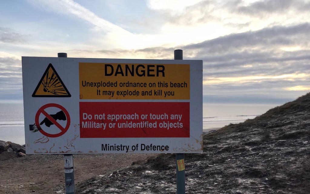
Between Mappleton and Aldbrough is an area of Ministry of Defence land that was formerly used for shelling. The beach is open though the adjacent land is “apparently” restricted. There are photos of ordnance collected up after bad weather has exposed unexploded shells and so I suppose the risk is genuine but probably quite low so long as one is sensible.

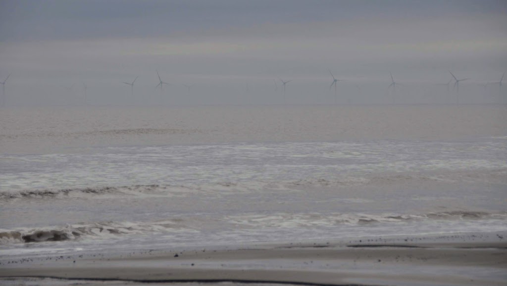
We walked past miles and miles of soft clay cliffs on one side and the sea and a view out to the Westermost Rough Offshore wind farm,8km out to sea. Amongst the concrete debris from WW2 there were clay boulders studded with pebbles formed as the sea rolled bigger lumps of clay into rounded boulders and small stones stuck to its surface.
I tended to walk closer to the base of the cliffs whilst Jill found it easier to keep a good pace by walking on the smooth, firm sand close the the water’s edge, dodging the incoming waves. It could be quite disconcerting to hear a dull thump and look round to see that a section of cliff close by has just slithered down and landed on the beach beside you.


Soon after we got on the beach we were able to see some sort of tall structure sticking out of the sea. We could also vaguely make out the vanes of the wind turbines out to sea. I knew this could not be the Hornsea Offshore Wind Farm because (despite its name) it is 120km offshore so far too distant to be seen. What we could see was the Westermost Rough Wind Farm and as we got closer it became apparent that the tower we had been watching for miles was in fact very distant from the wind farm and so probably unrelated.


We had seen no dog walkers all day presumably because the beach access was just too difficult. However, as we approached Withernsea. we started to come across many sea anglers. Assuming that this indicated that there must be a safe access point nearby I asked one of the anglers where he got onto the beach. He indicated a vague line down the cliff face and said he used his step ladder to help get over the muddy cornice at the top. Most of the anglers were wearing high waders and so I guess they were likely to be able to wade their way to safety if they were unable to scale the cliffs when the tide came right in.


There was a paucity of places to sit down for a comfortable cup of coffee. Neither of us find it easy to to sit comfortably on the flat damp sand and relatively few big boulders on which to perch a behind let alone two behinds.
Every so often there would be a pile of debris on the beach where a building had dropped off the cliff.
We got to Withernsea at 12:15 and had coffee and a snack and warm up in the Castle Café. When we moved on, the tide was lapping the sea wall below the promenade. We started to walk the cliff path but the initial part had disappeared and so we had to take a shortish diversion around a caravan park which was distinctly smaller than as depicted on my map.


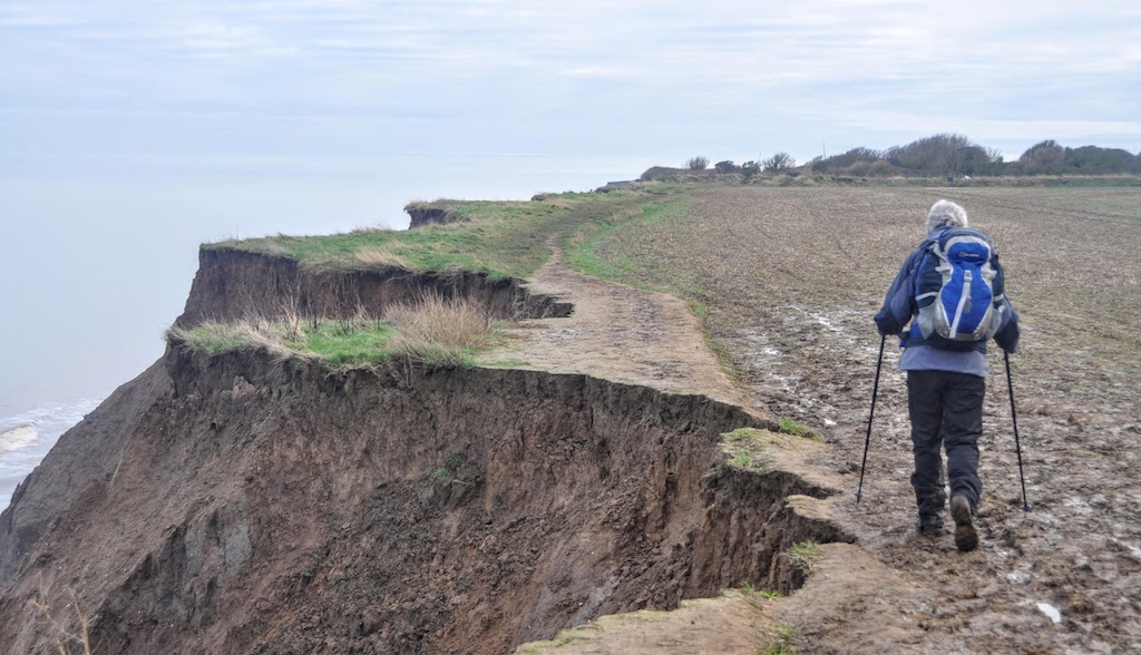

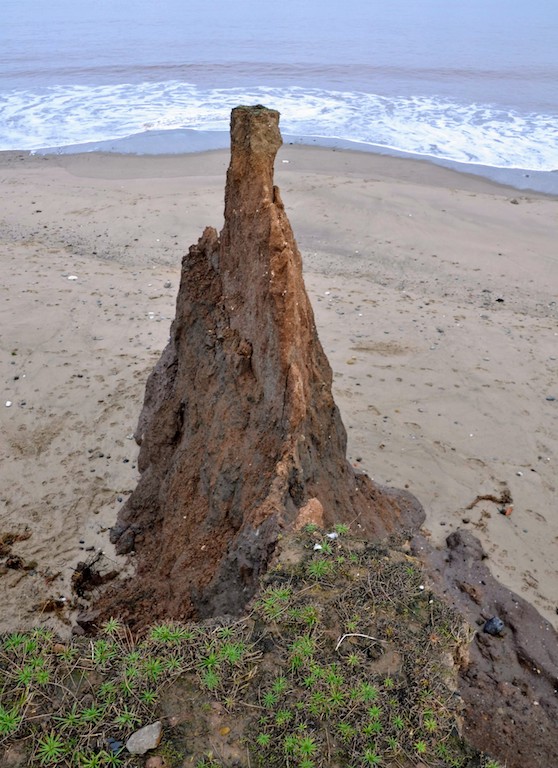
The 6.5 miles to Easington was a walk along a path that regularly disappeared off the cliff edge and there was clear evidence that crops planted this autumn had already fallen off the edge. We wondered whether the farmers were wise to use heavy tractors and plough right up to the edge of the cliffs; it seemed to us that this must accelerate the loss of land. Sometimes bizarre pinnacles of clay were preserved.


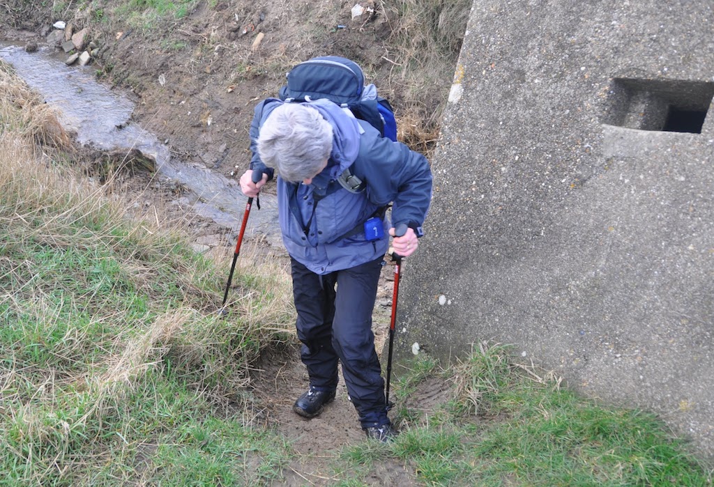
There were 3 dykes to cross and two of these were not too easy because of their steep sides and water in the bottom, whilst the third was facilitated by a WW2 pill box that had slipped into it.

We passed the Dimmington Wind Farm then the Easington Gas Terminal. This gas terminal receives most of the North Sea gas and so is a heavily protected piece of infrastructure. It had a double wired fence with a no-man’s land in between and the whole site has round-the-clock, armed police patrols.

We walked on into Easington and were just ringing for taxi when a bus arrived indicating it was going to Withernsea. So we hopped on the bus and arranged for the taxi to meet us at Withernsea and take us back to the car at Mappleton. Back in Hull we enjoyed a meal at a local Indian restaurant.


