It may seem rather pretentious to use the title of Carl Jung’s autobiography as the heading for this page but it seemed to sum up the contents better than anything else.
My long held dream of walking the coast of mainland Britain is, finally, done. The seed of this walk was planted many years ago. Back in 1971 I went on an expedition to Iceland and my enthusiasm for wild places began. A year or two later the leader of the expedition sent to the expedition members an old-fashioned duplicated copy of his account of his walk around the South-West Coast of Britain. This was before the official South-West Coast Path had been inaugurated. I was enthused by the idea but, I thought, ‘Why stop at the south-west? Why not go the whole way round the coast of Britain?’
The reality was that I had started at medical school and so there was no way I could embark on such a project for a long time. In 1978, whilst at medical school, I discovered that John Merrill was walking the coast of Britain and he phoned in regular reports to the BBC Today radio programme. His was the first documented walk around the coast of Britain. There was no longer any sense of urgency for me since I could no longer be first and so the project went on the back burner for the rest of my medical career.
I still dreamed of this walk from time to time but generally kept it to myself. I did read an account of a walk around the coast of Britain “The Sea on our Left” by the wife of a dentist who walked the coast together and skilfully used their Rotarian connections to help provide accommodation and support for their walk. Theirs is the only other complete circumnavigation by a married couple that I know of.
It was not until 2019 that I felt there was a pause in my life and the heat under the back burner was turned up and I started poring over maps. From then, for the next four years, my/our lives have been dominated by this project. It is true that we had almost a year off walking due to Covid-19 and the various restrictions and limitations that placed upon us but even then I could plan the route and dream on.
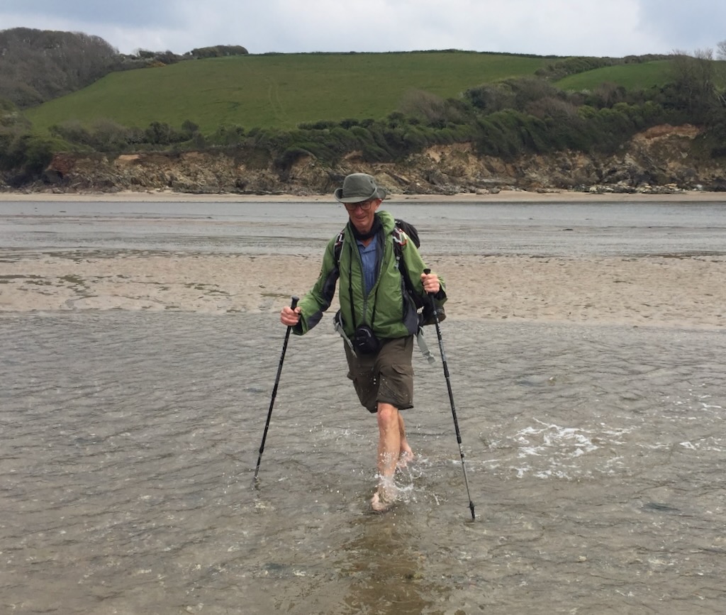
When I started out, I did not know whether I would really keep going. I have never been fond of the sea and have never enjoyed beach holidays. However, this walk has never been about the sea or sitting on beaches in the sun. We paddled in the sea rarely, usually only when the tide had come in unexpectedly fast or when we crossed rivers where they met the sea. We have reluctantly sat on beaches to eat our sandwiches from time to time but we prefer to find a rocky perch for our behinds if there is no convenient bench or grassy ledge.
For me, this walk has been one of discovery of the history and geography of our beautiful country and a journey of self-discovery and discovery of the resilience of my relationship with my wife. We are still happily married and I am sure we have a deeper understanding of each other. Even after forty-seven years of marriage there are things we can learn about each other – but perhaps not very many.
When Jill decided to join me on this walk, she had just had knee surgery and at the end of each day her knee would be swollen and she would rest it up enclosed in an elastic bandage and still be ready for a new challenge the next day. Jill has a remarkable ability to dig deep and keep going despite the odds. We never abandoned a walk on Jill’s account; indeed the only injury that required us to lose any walk-time was when I tore a calf muscle as we approached St Just’s shortly after Land’s End. I was indeed the weakest link.
Inevitably as I have planned routes with Jill we have imagined what the terrain will be like. The much-revered Alfred Wainwright said that he could look at maps and form an image of the terrain in his mind. He never reported whether that image was, in fact, accurate. I have been surprised by how bad I have been at predicting the terrain and difficulty or ease of walking from studying maps. Maps provide information on gradient and altitude by means of contours but the effort of climbing cliffs is determined more by the surface beneath one’s feet than the incline. Loose stone stone or slippery mud can make relatively simple climbs hard work whilst a firm, rocky ascent preserves your energy and can be exhilarating, elevating one both physically and mentally.
Even the relatively level places have their challenges. Sand dunes are an obvious example. No sensible walker will go out of their way to walk through soft dunes. There are some quite good, relatively stable paths along the tops of dunes particularly in an area of well-established dunes. Curiously OS maps make little differentiation between centuries-old areas of stable dunes and more recent, soft, shifting dunes which are a nightmare for walking and navigation.
Foolishly I had imagined that sandy beaches marked on maps were just that. In short, storms can move sand and shingle, and the shore line is far from constant. Sand itself varies remarkably. Just as the Inuit are said to have ten different terms for different types of snow I feel we need more than one term for sand. Walking along a damp, sandy beach can be an absolute delight; the surface can be as smooth as a billiard table and just as firm. In other places it can be rippled and very soft more akin to sinking into mud. Dry sand is generally best avoided because it is usually hard work and sometimes, if the grains if sand are very fine, it is extremely hard work. Fortunately we managed to avoid any sinking sands.
We have had one or two challenges on salt marshes mainly because there can be a myriad of little and not-so-little channels which will fill with the incoming tide alarming quickly. Even without the incoming tide, picking one’s way across can be messy and time-consuming.

Ordnance Survey maps remain a delight to use and are extraordinarily accurate – most of the time. Clearly coastal erosion does require maps to be regularly revised and, with the speed of erosion on the east coast, maps often show paths or indeed roads that no longer exist. The OS is very good at showing Rights of Way in England and Wales. However, just because a right of way exists it does not necessarily mean that there is a walkable path on the ground; there are places where another path has become established through custom and practice and usurped a Right of Way which can no longer be found, let alone followed. The OS seems to be quite slow at marking new, alternative routes even using the “other paths” pecked line symbol. Interestingly I have just noticed that the OS has managed to change the labelling of the England Coast Path to King Charles III England Coast Path – perhaps they have a “Find and Paste” facility. In Scotland the situation is considerably worse; there are very few “Rights of Way” and those that exist are marked no differently from all other paths. Scotland has introduced a system of “Core Paths” and each county or administrative area has created a list and map of these core paths. Unfortunately the state of the core paths is very variable. Some are proposed paths and do not fully exist though most are based on existing paths. It is intended that the core paths should be maintained to a minimum standard so that they are useable and passable. As yet this is some way off. In Scotland there are just too few walkers to be able to maintain a continuous coast path and, even where there is a designated path, it may be completely overgrown in the summer. There is the much talked about “Right to Roam” in Scotland which allows walkers to access most land excepting domestic gardens and farm curtilages and industrial areas. We have availed ourselves of this right many times on our walk. However, once access is gained, the terrain may not be readily walkable and just as there is a right to roam, land owners have a right to fence. The land-owning community have a particular predilection for barbed wire. As I have mentioned several times in the blog, I took to carrying a length of thick, foam pipe insulation which weighs almost nothing and can be put over barbed wire or indeed electric fences to enable safe and comfortable crossing.
Discussing access would not be complete without mentioning those landowners who resolutely resist access to their land and do their best to obstruct walkers. Scotland has some particularly bad examples where finger posts have been removed and direction posts dug out to try and deter walkers. Equally Scotland has had some very welcoming estates. In England the official coast path makes a few diversions where permission to route a coast path has not been granted. Notable examples are the north coast of Norfolk where the Sandringham Estate owns most of the land. We did, however, walk through un-impeded. In Essex, by contrast, the Benn’s (formerly Anthony Wedgewood-Benn) estate has denied access to the coast and it was certainly inaccessible when we walked that way. Fortunately it is only a small section of coast.

Landowners are not generally unpleasant people; they just don’t want general access to their land by all and sundry. Given the litter and lack of respect for the countryside by many visitors that is understandable. However, we have asked for permission to cross private land to keep us closer to the coast and we have never been denied access and some owners have been positively helpful. A simple phone call or email of explanation is usually all that is required.
I had a rather naive romantic idea at the outset that I would wander along the coast calling in at cafés and pubs along the way. Quite simply, as soon as Covid-19 restrictions came into force, that was impossible; all the booking ahead and queueing two metres apart made it untenable. By the time English regulations were fully lifted we were in north-west England and seaside cafés are less frequent. Scotland was later than England in abandoning Covid restrictions and they were still in force as we embarked on Scotland. Even without Covid, cafés tend to be clustered in towns and larger villages and, as the coast path rarely goes the centre of such places, one can often go for miles and miles with nothing at all. Even where cafés exist, they nearly always close by 4pm and often earlier.
I wish I could give a simple answer to the question “Which bit of coast have we enjoyed the most?” Firstly, it may be different for Jill. What I seem to recall as highlights of our trip are more the situations or wildlife than the part of the country or particular view.
I enjoyed my start from Berwick and down the Northumberland and Durham coasts but that was was very much because it was the realisation of what a great adventure I had embarked upon and discovering that I was still fit enough to undertake it.
I would, perhaps, liked to have taken the walk at a slower pace and explore more of the places we passed through. In reality, had we done so, it would have taken much much longer. There are too many possible places to visit along the way. Fortunately, Covid “put paid” to that because all the attractions closed down for the duration and so we had nothing to stop us piling on the miles.
The South West Coast Path was a great walking experience. The path exists and is way-marked and well used and so it is easy to follow. There were also a good number of villages and road access points and so we really made good time despite the considerable amount of climbing. We completed it in about 35 days which is a good deal faster than the “recommended itinerary” on the SW coast path website. We enjoyed the walk but it lacks the remoteness and wildness that we were to encounter in Scotland.
Scotland will remain a highlight of the walk, but not all of Scotland. We walked well over 2000 miles in Scotland and we had some truly memorable walks in the highlands where we experienced extremes of weather both hot and cold and extreme gales. We walked some of the most difficult terrain of the entire walk and stayed in some very remote locations. We saw a good range of wildlife. For me, the extremely cold, snowy days from Gairloch to Ullapool will remain some of my favourite walks, as was the Postie’s Path from Ardmair to Achiltibuie. Our walk from Blairmore to Sandwood Bay and onto Cape Wrath has to be memorable even if not all of the memories are good. After a week of fabulous weather it was on this remote walk that the weather started to break. It was damp and windy getting to Sandwood Bay and when we got there the tide was in and so we could not see the the full extent of the sands, let alone walk them. We had a good walk onward cross-country to the lighthouse at Cape Wrath and whilst it had its challenges we found it quite do-able. Our stay at the lighthouse felt quite surreal and took on the feeling of a nightmare as we shivered our way through the night as the storm broke. When we set off the next morning into the gale, we were glad to be on our way and to warm up. It was a pretty miserable tramp out and round the Kyle of Durness and the wind did not let up the whole day. To add to the miseries, Jill took a tumble and had a painful hip. But we made it round the remotest, most inhospitable corner of the mainland and it felt like a real achievement and I feel a sense of pride in that.
After rounding Cape Wrath, it felt as if we were on our way home. We still had a long way to go but there was a feeling of certainty. We also knew that we had grandchildren on the way, one with our daughter-in-law and another with our daughter. They were due two months apart, towards the end of the year and so we had a huge incentive to get our walk completed before they arrived.

Despite walking for about 5500 miles “together”, I have never quite managed to get my pace to match that of Jill. For no reason that I can really understand I nearly always finish up walking fifty or a hundred yards ahead but rarely more. I would always stop at gates or stiles or path divisions for Jill to catch up but then after a few minutes I would have drifted ahead again. I did try walking behind Jill but she really hated being aware I was just behind her and psychologically pushing her on. We have been together for fifty years and so we know how each other tick; we don’t actually need to walk closely together to enjoy and share our walks.
I remain in awe of Jill’s ability to pull out a little bit extra when the going got tough. When she joined me at Saltburn she had a post-operative knee to contend with. At various other stages she had blisters or other minor injuries which made it tough for her. There were numerous times when I declared that we really needed to “get a move on” or we would miss the bus/train/tide or get benighted. Each time Jill would find a little extra from somewhere and increase the pace and we nearly always reached our destination with a few minutes to spare.
There is always a danger that ending an epic adventure can become an anti-climax. We were very fortunate that Emily arranged to accompany us from the Scottish border to Berwick; we were overjoyed when Joe and his dog Frank appeared, having caught the early train from London and then walked north from Berwick to meet us just south of the Scottish border. It made for a wonderfully memorable finish to our walk.
People always want to know how far we walked. That is difficult to answer. We had three GPS devices in operation most of the time but we both changed our iPhones during the course of our walk. We used my stand-alone GPS device consistently for the entire walk but that occasionally failed. Despite the accuracy of GPS, our devices never recorded the same distances. Whilst some of that may be explained by us walking very slightly variations of the same paths (and the greater distance Jill would take to the ladies’ loos) it does not explain the 5%+ variation. I never really understood what caused the differences. For the most part I have recorded the minimum distance recorded and the total was 5299 miles but it could have been more than 5500. In short, the distance doesn’t really matter. There is no prescribed route and the distance walked will depend on tides, river crossings and if you included distances walked to access the coast as opposed to along the coast. It is a long way. As for height climbed that is a bit of a mystery because GPS devices are even less accurate for height. However, some days we climbed several thousand feet and on other days we would have been delighted to find an incline to relieve the flatness.
As to how long it takes that depends on how fast you walk, of course! We actually walk quite fast and counting all the days on which we walked, even if we only walked half a dozen miles on the first day of a section to loosen up after the journey, we walked on 318 days and walked an average of just under 17 miles a day. On our full days’ walking, we averaged 17.5 miles per day.
As for our best and worst days it is probably unfair to judge. You cannot enjoy the good unless you endure the bad. We experienced everything on our walk and had a really great experience – and, yes, I would do it all again.

What lovely write up and summary from you and Jill. I enjoyed reading it. Funnily enough writing this on the train back from a coastal walk, to rewalk the coast between Kings Lynn and Hunstanton as the England coast path has opened up a new route much closer to the coast. Which makes me realise when I finish (hopefully this year) i won’t really have finished as the coast, and access to it, does change over the years.
LikeLike