Day 23 – Horse Shoe Point to Mablethorpe 19.8 miles

Monday 17th February 2020

Yesterday had been a long day and this was to be just over 14 miles to provide a lighter day. 

We drove to Horse Shoe Point and picked up where we had left off last night. There was a cold and very strong wind blowing across the dykes – the tail end of storm Desmond. We started along the dyke trying to walk a straight line but being buffeted all over the place by the wind.

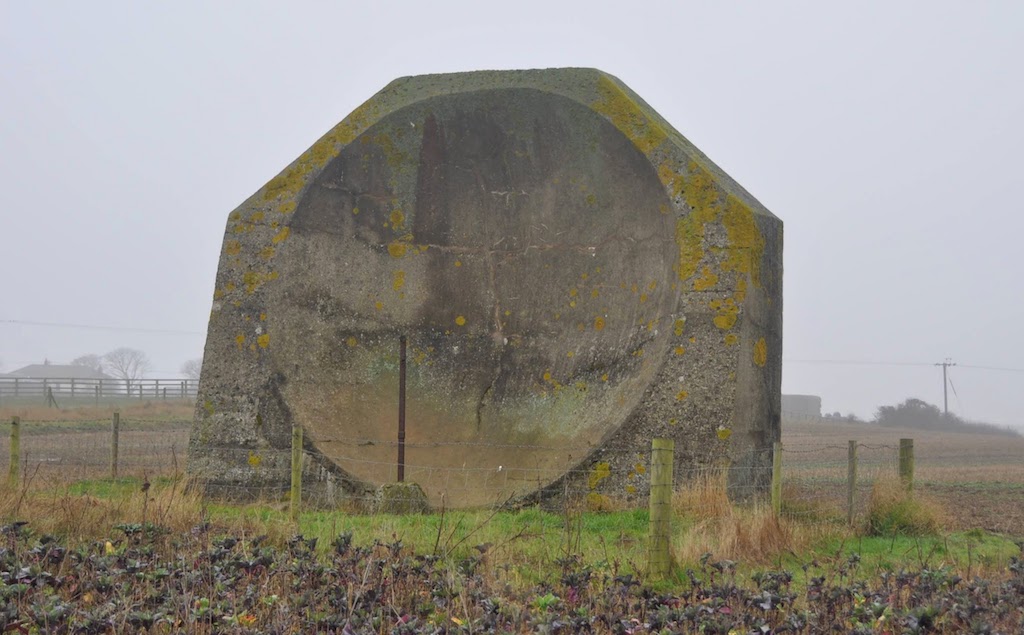
We came to a gate to a dyke off to our right with a notice which informed us that the path was closed at Pye’s Hall. I checked the map and  found  Pye’s Farm which was not on our route  and assumed Pye’s Hall was near it or was one and the same, and so we continued on our way. Oddly two locked gates with warning signs barred our way but climbing them presented no problem. Then we saw the error of our ways. A huge breach in the sea wall presented us with an insurmountable block to progress. I expressly forbade Jill from attempting to walk up the side of the water course which had been partially canalised which she might have attempted – not realising that there was an alternative without going right back to the start of the day’s walk.

We retraced our steps to the “path closed” sign and realised that it had probably swung round in the wind. We set off along the alternative dyke which, oddly, is not marked on the 1:25k OS map though it is on the 1:50k map. This took us around the breach. At the end of the dyke, we came to Donna Nook where an information board explained that Pye Hall was a large, old, Victorian house on the dyke built by Alfred Pye, a solicitor, who subsequently defrauded his creditors and escaped to Belgium. The Hall was dismantled in the 1970s hence it does not appear on maps.

From subsequent research it appears that the Environment Agency requested to make the breach in the wall and realign the sea defences as part of a compensation scheme for loss of salt marsh elsewhere. An application was made to reroute the footpath and was successful despite local opposition.

Once back on route we covered the ground to a nature reserve car park at Donna Nook. We got onto the beach and followed hoof prints around the edge of the beach until we reached RAF Donna Nook. This section of the Humber Estuary is a bombing range and red flags were flying. I spotted a footpath sign directing off the beach and followed it through the very small RAF base to the road. Unfortunately no other path returning to the sea wall was apparent and there was the usual private no access signs on all the tracks. We asked a couple of local farmers about access and they advised returning through the RAF base to the beach and following the edge until we reached the sea wall again and said  we could walk all the way to Saltfleet. We started well but due to big puddles close along the top of the beach it was easier to walk a bit further out and we were following horse tracks, dog prints and tyre tracks of a large vehicle and so it seemed reasonably safe to do so.

The tracks turned into shore by an RAF observation tower. I was for following the tracks but Jill persuaded me that walking over the mud flats was going to be much easier. It was for a while but trying to avoid the wettest bits we were straying further away from the land and deeper into the bombing range and we could clearly see the targets. I was not too happy but the way back to the shore was barred by a lagoon. So on we went. Fortunately no aircraft appeared. Eventually I had had enough and was determined we should get back to the safety of the sea wall; I wished neither to be bombed nor drowned by the incoming tide.

The route we had been walking was not totally lacking in interest. There were some birds including Snow Bunting. There were old bones of seals washed up and occasionally the entire remains of a seal.

The problem we encountered were deep gullies of water which intermittently blocked our way. Eventually I found a away which got us within 100m of the sea wall but a big pool of water with connecting gullies was separating us from it. Getting past on the left got very wet but trying on the right we found on old track and followed it until it petered out near a slightly raised bank with some bushes. We struck out towards land but were blocked by a wide deep canal quite impassable. We then had to retrace our steps and retry the left side as best as we could. With a bit of gully jumping and sploshing we made it to the safety of the sea wall.
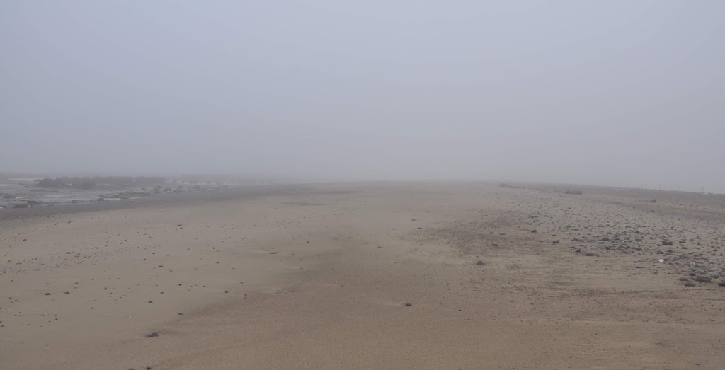
We had wasted a lot of time and put in much effort and extra distance but at least we were safe. After a mile of sea wall we came to Saltfleet  and had lunch (bacon butties from breakfast) sitting on a bench overlooking the salt marsh.

We walked through Saltfleet and crossed the Great Eau. We had a choice of walking along the sea margin between the dunes and the water’s edge or a way-marked path through the dunes themselves. From our experiences in the morning we were happy to wind through the dunes. The dunes here are quite old, established dunes with many small trees and bushes and a stable surface to walk on. Despite being a nature reserve we did not see a great deal of wildlife. Every so often we went through a carpark and access point to the beach but I was happy walking where we were. 

Shortly before Mablethorpe we got into caravan territory with rank after rank of static caravans. In Mablethorpe we stopped at the main beach access point and called a cab for quite a long drive back to Horse Shoe Point to collect the car and drive to Skegness where we would stay for two nights. Instead of just over 14 miles, our “lighter day” had morphed into a very taxing 19.8.

Jill at Mablethorpe

Day 22 – Immingham to Horseshoe Point 19 miles

Sunday 16th February 2020

Today would be a long walk and with storm Desmond threatening high winds and rain we wanted to be off in good time. We caught the 7:47 bus from Grimsby to Immingham and started walking at 08:15.

Looking back to Killingholme
Grimsby and its hydraulic accumulator tower

We had a mile or two around the remainder of the the docks until we reached the sea wall. Once on the sea wall, our walk was much as yesterday’s. On the seaward side the tide was right in and on the landward side we walked past a variety of industrial sites with little to recommend them. We were amused by this warning sign outside a chemical plant and rather wished that the chemical plant looked better maintained. On the seaward side Jill was happy spotting birds.

Ahead of us was Grimsby Docks and notably the Grimsby tower stood out on the horizon. This red brick tower was built in the mid 19th  century and was a hydraulic accumulator tower. Essentially it stored water at a great height which was then used to power machinery in the dock.

As we approached Grimsby we had to turn inland to get round the docklands; this involved walking alongside a dual carriageway and other fast roads and then through some urban decay. Jill glanced down a side road and spotted a pedestrian footbridge over the railway line and correctly surmised that it might take us back to the sea wall. We sat on the sea wall and had some coffee and buns (from breakfast).  After half a mile of sea wall, we came to Cleethorpes beach and promenade which was really quite busy considering a major storm was promising high winds and rain.  We stopped for a light lunch at Oliver’s on the seafront and had a good warm up.

After lunch we got going gently and reached the end of the prom where we chose to walk on a sandy track which ran across the foreshore. It was pleasant to be on a softer surface. However we were on tidal territory and there were streams running across. We coped with a couple of small streams but then came to a significant outflow which required an about-turn and finding a way across the marshy strip separating us from the tarmac seawall path.

We passed a large collection of shacks behind the dunes. These were w/e and holiday homes that were put up really as a predecessor to the modern static caravan parks, but that was back in the pre-war era when planning regulations were less strict. Then we came to the Humber Mouth Yacht Club where we turned slightly inland to get on to a grassy dyke across Tetney Marsh. Across the marsh we saw several egrets, lots of curlew and lapwings, Brent geese, swans and many small birds.

On the seaward side we were delighted when we could spot the Spurn Head lighthouse which we had walked to on our last section of walk. It really is a very long way round, reminding us just how big the Humber Estuary is and how far Spurn Head hooks round the estuary. We could also see the two forts that guard the mouth of the estuary. These were started in WW1 but not completed until 1919. They were renovated during WW2 and finally abandoned in 1956.

We experienced our first proper rain of the day but, though it became very dark, the rain did not last long.

As we approached the Louth Canal, I could see some Heras fencing and red tape. When we got there our worst suspicions were confirmed; the path to the bridge over the canal was closed for flood protection work. This was going to involve a two mile diversion up to Tetney Lock and back down the other side of the canal. However, Jill saved the day by forcing her way through the barriers and up to the bridge which we crossed with ease before scaling the gate the other side to regain the dyke. We were clearly not the first walkers to have performed this manoeuvre.

We followed along the dyke having only another 2 miles to reach our destination at Horse Shoe Point. Just  half a mile from our destination there was another path closure for engineering works. Fortunately, though it looked, from a distance, very securely fenced off, previous walkers had disconnected the Heras fencing and made a walk through. The final half mile was made against a suddenly darkening sky we reached Horse Shoe Point just as the squall arrived. I phoned for a taxi and then we both hid behind a big wooden sign (listing all the risks and hazards and safety info of the engineering site we had just negotiated)  and sheltered from quite a violent squall. Then the taxi arrived and took us very slowly back to Grimsby.

Day 21 – Barton-upon-Humber to Immingham 17 miles

Saturday 15th February 2020

We got up early and left home about 7:15 to drive to Barton-upon-Humber.  We arrived and were walking by about 9:30. Fortunately, though storm Desmond was destined to arrive soon, we set off with just a gentle breeze and just a few drops of rain in the air. We walked up the path to the Humber and climbed up on to the seawall to start our walk.

Jill at Barton

Our entire day would be spent walking along the seawall. To start with it was a grassy embankment and we had to views back to the Humber Bridge and across to Hessle on the north bank and further along towards Hull. The moisture in the air meant none of our views were particularly clear.

Humber Bridge

At Barrow the path diverted on to the railway bridge to get over Barrow Haven and wind through a timber yard.  We continued along the way buffeted by the wind which was coming from the south-west meaning that it was hitting us at an angle from behind so providing a little bit of forward push but it was certainly very gusty and would frequently send us across the path in a slightly zigzag fashion.

 At New Holland the path took another inland diversion to get through the small industrial area where we entered through big steel gates and then followed a carefully demarcated path between the warehouses and the driveways for lorries.  The place was deserted but we were probably being monitored on CCTV. Then we were back on the seawall once more.

The tide was well in and there were little waves lapping up against the seawall and also, quite significantly, the landward side below the seawall was definitely lower than the water on the seaward side.

We saw hardly anyone along the seawall; at one point there was a young woman running with  four dogs and then a little later we saw an older woman also running but apart from that I think there was one dog walker and then eventually much, much further on we saw one sea angler. 

There was a fair amount of bird activity.  Thrushes and blackbirds raced along the hedgerows but on the seaward side we saw turnstones on the edge of the seawall and then to our surprise all of a sudden a barn owl appeared from the hedge.  It rose up into the air performing aerobatics to try and maintain stability and then disappeared over the fields presumably hunting for voles and mice trying and get a meal in before  the storm arrived.

Shortly we reached the turning point at Skitter Ness  where our path turned from going west to east to an almost north south route. I thought that turning into the wind was going to make the next seven or eight miles almost unbearable.  However, as it turned out, the wind was far from continuous and though occasional gusts would suddenly set us back we made quite good progress.  We had hoped to find some shelter and stop to eat our lunch but in the wind and intermittent rain it seem better to just keep going.

The seawall on this section was initially still a grassy bank but before long this was replaced by a concrete track with a low seawall rising about three feet above the roadway. 

The distant view was rather limited though soon after turning the corner we could see the ships moored at the jetty at Killingholm and from miles away we could see the trucks being shuttled on to the ferry.

We saw another barn owl rise up from the hedge on the landward side and  practise its aerobatics to gain control and then disappear along the hedge-line hunting for small mammals. To the seaward side we saw a huge flock of lapwings which were initially on the mudflats and then all took off together to circle around before settling down again little further along; amongst them were a few oystercatchers and curlews and further on Jill spotted some shelduck.

As we approached Killingholme there were rows and rows of cars and further along rows of containers.  The path became closed in by steel paling fences on both sides.  Eventually our way was barred by steel gates.  A notice instructed us to press a button before entering.  This we did and a klaxon alarm sounded.  I struggled to open the gate by passing my arm through the gate and drawing the bolt back.  We got through the gate as a young, female, security officer arrived.  She escorted us across the access road used by the lorries loading the ships and through another steel gate giving access to another footpath lined each side by more steel palings.

Once through the dock we regained the sea wall but now the landward side was a continuous line of industrial sites and incoming LPG pipelines.  About 2.5 miles from Immingham the path turned inland to circumvent the docks.  I was expecting to go over a level crossing but there was a new bridge rather hump-back in nature to enable lorries to get in and out of the docks without the inconvenience of waiting for trains.  Curiously that was the highest point on our day’s walk at about 100ft. There followed a dreary walk alongside a dual carriageway into Immingham. The bus service we planned to use has mysteriously stopped running and so I called a taxi to take to take us to Barton to collect the car.  Whilst waiting for the taxi we sat on a bench by the war memorial and had a belated lunch.

Day 20 – Paull to Barton-on-Humber 17.9 miles

Saturday 25th January 2020

This was the final day of this section of our walk.  Though there are not many buses that go to Paull, there was an early bus that arrived at about 8:30 which suited us well.  We started walking along another section of dyke but, after a mile or so of this, we reached the chemical works and the path leaves soft ground and we would be on concrete and tarmac for the rest of the day.

old barge rotting in Paull Haven

In theory we would following the Trans-Pennine Trail as far as the Humber bridge.  After a short stretch along the busy road, we turned into Queen Elizabeth Dock and were surprised to be asked for photo-ID at the sentry gate.  

As we followed the path round the inside of the perimeter wall/fence, a van pulled over and the driver asked us where we were going. He said there was no way through from King George Lock to Alexandra Docks so I showed him our map and, somewhat unconvinced, he drove off.  He obviously told someone of his encounter as, a few minutes later, another van stopped beside us and two workmen got out.  They told us to put our gear in the back as they were going to take us out of the docks; we were not supposed to be there.  When I said we were following the Trans-Pennine Trail, he walked me to the perimeter wall/fence and pointed to the disused, narrow, concrete path between the wall and the deep water of the Humber on the other side – “That’s the Trans-Pennine Trail – but you can’t get along there as it’s blocked off before Alex Dock”. 

So we were driven back out to the road and, being as helpful as they could be, they took us round to close to where the Trail resumes after the footpath closure.  We walked down to where the Trans-Pennine Trial should emerge from the King George Dock. There we found a large notice saying the footpath was closed due to emergency/essential maintenance works at the lock entrance – but the age of the sign suggested that this is now permanent.

There was also this attractive steel Oystercatcher made from a chain mesh. 

It was interesting to walk past the Siemens’ site and see just how colossal offshore wind turbine vanes really are.

Unfortunately due to renovation and flood protection work around Hull, the trail is currently fenced off around most of the city and we had to thread our way through urban housing estates to reach the centre of Hull

Even here the lock gates over the marina were closed for maintenance and so we had to walk the length of the marina and cross the busy dual-carriageway twice and back down the other side to make about 15 ft of progress. 

The marina is full of small pleasure craft.  I was interested to see the Spurn Light ship. This was formerly moored 4.5 miles east of Spurn Point, aiding navigation into the Humber estuary.

We did manage to walk along St Andrew’s Quay but this is little more than a fenced in, concrete alley-way through semi-derelict dockland though it did start with crossing the lock gates and then an elevated walkway over the roofs of many many warehouses.

There were more diversions through the out-of-town shopping centre.  We did regain the Trans-Pennine Trail for a short way to the Humber bridge but here again we were stymied by the pedestrian access path to the  bridge being closed off.  So we had to make a diversion through the country park and eventually made our way on to the east footpath across the Humber Bridge. 

Once on the bridge it was simple walking to the other side though, much as our walk had started on cliffs above Saltburn, so it ended with lots of warnings urging people not to jump, in this case off the bridge.  Curiously, that morning, there was a report on the morning news that they are thinking of a partial closure of the pedestrian walkways at night to make it more difficult for suicidal people to get on the bridge.

From the bridge

Finally we had a short walk into Barton-on-Humber where we were stopped by an elderly gentleman who asked about our walk. He said he had walked much of the coastline himself and thought I was “good for another 20 years’ walking”. I hope he’s right!

Then we caught the bus back to Hull.

We had walked about 170 miles over the last ten days and Jill had done the lot. Her knee had complained from time to time along the way but her biggest problem over the last three days was a “knotted” muscle in her shoulder.  The walk had been rather different from what we had expected, and some of the sections I thought would be very dull were interesting and vice versa.

We headed home ready to plan the next stage of our coastal odyssey.

Day 19 – Outstray Farm to Paull 14.9 miles

Friday 24th January 2020

Today we left the car at Paull, the end of the day’s walk, and got a taxi to Outstray farm. This was convenient because we could book the taxi the night before and be less susceptible to the the problem of all the taxis being booked for school runs in the afternoon.  From Outstray Farm the entire day would be spent walking along the top of the dyke.  In theory it should be very easy walking but the grass was often long enough to offer enough resistance to prevent striding out.

Near Outstray Farm is a monument recording that between 1983 and 1985 the outer banks of the Humber Estuary were raised to 3.3m above mean high water level.  We noted with interest that the John Merrill, the first coast walker, had walked miles inland between Spurn and Hull along roads. It may be that the previous dykes were not walkable or that they were not rights of way which Merrill insisted he used.  

The path we followed did not appear as a right of way on the maps but there was a well-defined path all the way to Paull.  There were one or two indents in our walk where, whether by accident or design, the original dyke had been breached by the sea and the new dyke took a little inland diversion. 

We saw lots of birds on the landward side including reed buntings, barn owls, yellow hammers, goldfinches and more Brent geese. On the seaward side there were curlews, oyster catchers, sandpipers and probably many others.  Near Paull we spotted three barn owls in one place. 

Furthermore we were quite surprised by the number of fallow deer grazing in the fields and the salt marsh. I normally think of fallow deer as being woodland animals and there was very little woodland around the dykes.

For lunch we sat on a washed up log on the seaward side of the dyke and watched the birds.

The day ended at Paull where a convenient tap in the allotments allowed us to clean our boots odd before driving back to our hotel in Hull.

Day 18 – Easington to Outstray Farm 19.5 miles

Thursday 23rd January

The day dawned dull.  A mist hung over the countryside and out into the Humber Estuary.  This was the day I had promised Jill would be a really interesting walk.  We drove from Hull to Easington seeing very little. We parked in the cliff top car park and reassured ourselves that it was unlikely to disappear over the edge in the course of a single day.

We set off from Easington along the coast path behind the Beacon Lagoons to Kilnsea and the start of the Spurn Point sand spit.  On the way we passed a huge concrete reflector which I correctly deduced was a sound reflector.  These were constructed during WW1 and would have had a microphone at its focal point to pick up the distant sound of approaching Zeppelins. A worthy technology of its time, it was rapidly made redundant by radar

Spurn Head is a three mile sand spit that hooks around the mouth of the Humber but in December 2013 a huge tidal surge broke through the sand spit at its base and Spurn point became a tidal island. We had timed our walking around the tides to ensure we had plenty of time to walk to the life boat station at the far end and back before high tide.  I had thought we might walk on the sand but it is actually rather softer than the sand further north and so we resorted to walking the old road.  There were none of the wide vistas I had been promising and birds, if any, were difficult to see through the gloom. Even the lighthouse was a surprise when it suddenly appeared. We were beginning to feel cold and damp and so after photographing the Lifeboat Jetty (I couldn’t see a lifeboat) we headed back along the the track to the Yorkshire Wildlife Trust Discovery centre (and café) where we warmed up and had an early lunch. 

The next part of our walk would be along the dyke which stops Holderness becoming part of the Humber Estuary.  The top of the dyke is about 3 metres above sea level and, with the eye of faith, I thought the mist had cleared a little; Jill was unconvinced.

 We did see some little egrets, Brent Geese and sandpipers.  The dyke was deserted except for a couple of bird-watchers and a dog-walker who stopped for a chat and whose dogs entertained us.

As we approached Winestead Drain, we turned inland. The Drain is a substantial canal which terminates at the sea with a large pumping station which is securely fenced off. Walkers have no choice but to walk inland to Outstray Farm where there is an agricultural bridge across the Drain.  From here we arranged a taxi to take us back to Easington and collect the car.

Day 17 – Mappleton to Easington 20.3 miles

Wednesday 22nd January 2020

Today was to be another long day; this time an estimated 20 miles which turned out to be spot on. We were later leaving the hotel than planned but even so we were walking by 08:30.  We were hoping to reach Withernsea (12 miles) by 12.30 when the rising tide might restrict our progress.  The day was dull and a bit misty.

Morning light Mappleton

There was no safe exit point from the beach at Aldbrough and so, had we been walking on the beach the previous afternoon with a rising tide and continued beyond Mappleton, we could have been in real trouble. Indeed I think that there was probably only one safe exit point all the way between Mappleton and Withernsea.

Between Mappleton and Aldbrough is an area of Ministry of Defence land that was formerly used for shelling. The beach is open though the adjacent land is “apparently” restricted.  There are photos of ordnance collected up after bad weather has exposed unexploded shells and so I suppose the risk is genuine but probably quite low so long as one is sensible.

We walked past miles and miles of soft clay cliffs on one side and the sea and a view out to the Westermost Rough Offshore wind farm,8km out to sea.  Amongst the concrete debris from WW2 there were clay boulders studded with pebbles formed as the sea rolled bigger lumps of clay into rounded boulders and small stones stuck to its surface.

I tended to walk closer to the base of the cliffs whilst Jill found it easier to keep a good pace by walking on the smooth, firm sand close the the water’s edge, dodging the incoming waves.  It could be quite disconcerting to hear a dull thump and look round to see that a section of cliff close by has just slithered down and landed on the beach beside you.

Soon after we got on the beach we were able to see some sort of tall structure sticking out of the sea.  We could also vaguely make out the vanes of the wind turbines out to sea. I knew this could not be the Hornsea Offshore Wind Farm because (despite its name) it is 120km offshore so far too distant to be seen. What we could see was the Westermost Rough Wind Farm and as we got closer it became apparent that the tower we had been watching for miles was in fact very distant from the wind farm and so probably unrelated.

We had seen no dog walkers all day presumably because the beach access was just too difficult.  However, as we approached Withernsea. we started to come across many sea anglers.  Assuming that this indicated that there must be a safe access point nearby I asked one of the anglers where he got onto the beach. He indicated a vague line down the cliff face and said he used his step ladder to help get over the muddy cornice at the top. Most of the anglers were wearing high waders and so I guess they were likely to be able to wade their way to safety if they were unable to scale the cliffs when the tide came right in.

There was a paucity of places to sit down for a comfortable cup of coffee.  Neither of us find it easy to to sit comfortably on the flat damp sand and relatively few big boulders on which to perch a behind let alone two behinds.

Every so often there would be a pile of debris on the beach where a building had dropped off the cliff.

We got to Withernsea at 12:15 and had coffee and a snack and warm up in the Castle Café.  When we moved on, the tide was lapping the sea wall below the promenade.  We started to walk the cliff path but the initial part had disappeared and so we had to take a shortish diversion around a caravan park which was distinctly smaller than as depicted on my map.

The 6.5 miles to Easington was a walk along a path that regularly disappeared off the cliff edge and there was clear evidence that crops planted this autumn had already fallen off the edge. We wondered whether the farmers were wise to use heavy tractors and plough right up to the edge of the cliffs; it seemed to us that this must accelerate the loss of land. Sometimes bizarre pinnacles of clay were preserved.

There were 3 dykes to cross and two of these were not too easy because of their steep sides and water in the bottom, whilst the third was facilitated by a WW2 pill box that had slipped into it.

We passed the Dimmington Wind Farm then the Easington Gas Terminal.  This gas terminal receives most of the North Sea gas and so is a heavily protected piece of infrastructure. It had a double wired fence with a no-man’s land in between and the whole site has round-the-clock, armed police patrols.

We  walked on into Easington and were just ringing for taxi when a bus arrived indicating it was going to Withernsea.  So we hopped on the bus and arranged for the taxi to meet us at Withernsea and take us back to the car at Mappleton.  Back in Hull we enjoyed a meal at a local Indian restaurant.

Day 16 – Bridlington to Mappleton 16.6miles

Tuesday 21st January 2020

 Today we had an early start because we wanted to walk as much as possible along the sandy beaches as far as Mappleton (or even Aldbrough if possible) and so it would be a long day. High tide was not until about 14:00 and so I estimated we should try and be off the beach by noon or soon after. It is always difficult to know whether the tide reaches the base of the cliffs before high tide and also where one may be able to exit the beach safely.

 We were on Bridlington beach in time to watch sunrise and then we got into a good stride along the beach. Once again we had a bright clear morning. The sand was extensive and uninterrupted excepting for the remains of WW2 defences.  We could make good time and were only slowed by the occasional river crossing.

There were very few rocks or indeed anything to make a seat for a coffee break. The cliffs were now predominantly low, drippingly wet mud and clay.  Wherever we looked there was evidence of erosion.  Cliffs here erode from the top.  The exposed edge of clay shrinks and cracks when it is dry allowing water to penetrate deep into the ground weakening it until a wedge of clay and its turf topping slip down the cliff.  More rain and drainage water washes the clay down to the sand and sea steadily washes it away.  Every so often as we walked we would hear a slither and thump as another section of cliff dropped to the sand below.
And so the beach and cliff went on and on and on. 

Eventually, near Skipsea, I was aware the tide was coming in and I could not see clear sand beyond a sticking out bit of cliff and so we took the access point by the caravan park to get on to the cliff tops and went for a mile or so before we could see clear beach again and found a suitable access point next to a private slipway.  We clambered down over the sea defences.

From there we followed the sand to Hornsea where the cooperatively run Floral Hall provided us with an excellent light lunch.

I enquired of the local dog walkers of the feasibility of walking the beach as far as Mappleton but none of them seemed to know.  We set off, planning to get onto the sand again if we could.  As we passed the Coastguard station a very helpful coastguard appeared and we made enquiries.  He explained that we should definitely not try walking the beach any further and we should definitely not try scaling the cliffs because they were highly likely to fall, taking us with them and that the coastguards had lifted at least three people off the beach last season when they got trapped by the tide.

We struck out along the cliff top looking down at the sea almost lapping the base of the cliffs.  The tide had come in a long way during the half hour or so we had spent in the café.  The walk along the cliff top was interesting since rather frequently it had disappeared.  Fortunately there was not too much on the landward side to prevent us getting along.

We made Mappleton quite quickly.  Since we were quite  tired it seemed better to finish there rather than struggle along the cliff top another three or four miles to Aldbrough when tomorrow we could do it at low tide along the firm sand with ease. By 15:30 we had arranged a taxi back to Bridlington from where we drove to the Ibis hotel in Hull which would be our base for four nights as we walked around Holderness.

We had a rather disappointing meal at the Lantern Restaurant which had aspirations to be Cypriot in style but fell well short of the mark.

 By contrast the Ibis hotel, though basic, fulfilled our needs admirably providing B&B for about £45 per night for the two of us – now that is a bargain.

Day 15 – Bempton to Bridlington 13.5 miles

Monday 20th January 2020

Today’s walk was to be a lighter day and we needed it to be so after yesterday’s long tramp.  We had a six minute train ride back to Bempton and then walked to the RSPB Centre for a tactical pause and then got back on the coast path once more.

We had walked around Flamborough Head the previous year albeit in the opposite direction.  We were surprised how much erosion had taken place since then, even on these hard, chalky cliffs.  Admittedly it was mainly the clay cap that had disappeared into the sea but sections of path we used last year were no longer in existence.

Flamborough Cliffs

Once again it was a beautiful sunny day. We enjoyed looking at the birds and dropped down to have lunch by the RNLI Flamborough life boat station at South Landing where we were sheltered from the breeze but had the warmth of the sun.

Once past the Dyke we had a gentle downhill stroll into  Bridlington past tens, if not hundreds, of wooden benches each a memorial to someone who loved that view.

Finally we had a short stretch of sand before arriving back at our hotel.

Oyster Catchers

 We decided to eat away from the Premiere Inn that night and found a Chinese restaurant since not much else was open being a Monday night. To our surprise they were expecting a big party that night. A little later the staff from the Premiere Inn arrived to enjoy their Christmas party. (You can eat out but you never truly leave the Premiere Inn.)

Day 14 – Scarborough to Bempton 21.8 miles

Sunday 19th January 2020

Last night was cold and there was a sharp frost.  The windows of our chilly accommodation were running with condensation.  The central heating was not on in the morning so we dressed quickly and made up Oats-so-Simple using the room kettle and departed just as our hostess appeared.

We were close the finish of yesterday’s walk and were soon following the Cleveland Way once more. Unfortunately Cayton Bay was not convenient for walking along though there were a number of early morning surfers out already.  A beautiful, clear day was in prospect and a couple of dry days and the hard ground frost meant that the cliff top path was much more walkable than on previous days.

We trundled our way along the cliff path until Filey Brigg, an impressive promontory and reef protruding into the sea.  Being a sunny Sunday, lots of people were out enjoying a walk out along Filey Brigg.

Filey from the Brigg

From the Brigg it was a short walk to Filey where we paused at the RNLI shop and Jill bought a baseball cap so she had a sun-visor and then we stopped for lunch at a prom cafe.

From the end of the prom at Filey we were able to get down onto the sands. It was a glorious afternoon and we could make good time on the damp sand. There were lots of small, circular jellyfish washed up on the sand and several small flocks of seabirds feeding along the water’s edge.

Across Filey Bay to Bempton Cliffs

However, there was a rising tide and the nature of the cliffs had changed; they were now soft, clay cliffs which looked impossible to climb.  Not wishing to be cut off by the tide, I asked a local dog-walker about  exit points from the beach. He advised going as far as Reighton Gap and climbing the degrading concrete steps to the cliff where he said we could turn left through the caravan site and continue on the cliff path.

We strode on and found Reighton Gap. The muddy base required some negotiation but once on the concrete steps, even though they were at bizarre angles, it was easy enough to reach the top.

The caravan site was massive.  We started along the cliff path but found our way blocked by Heras fencing right up to the edge. We retraced our steps and tried a different way through.  Alas our way was blocked once more. There was some pretty serious maintenance work going on.  There was simply no way through. The choice was back onto the beach and hope to get off the beach further south or a long in-land diversion. Safety dictated the inland diversion but it turned out even longer than expected because the footpath I planned to follow had itself been diverted.  We walked through Reighton and then Speeton where there was an attractive church where we joined the Headland Way

It was four miles before we regained the coast path, just over a mile from where we had left the beach over an hour before.  I was now becoming just a little anxious since we were certainly going to finish after dark and I was not keen on walking the Bempton cliff path in the dark.

North from Speeton Cliffs across Filey Bay

There was a steady climb from Speeton Cliffs to the top of Buckton cliffs where we watched the sun dip below the horizon and from the adversity of our long detour came forth the brilliance of a spectacular sunset.

We stopped for a rest and some flapjack and coffee before setting off again the last three miles to the station.  Every few yards we looked back to enjoy the stunning sky until dusk closed in around us. Fortunately we we reached the branch path to the RSPB visitor centre as darkness overtook us and walked along the road to Bempton station by torch-light.

There is an hourly train from Bempton back to Scarborough and when we were still half a mile short of the station we saw a train go through.  Once again we killed time in the shelter on the platform, putting on extra layers and finishing off food and drink until the next train came. 

Half an hour later we were walking out of Scarborough to where we had parked the car and drove to the Premier Inn in Bridlington where once again we had a room with a bath.  We were very tired and so we ate in the restaurant there.  It was standard food but all the better for not having to go out.

Design a site like this with WordPress.com
Get started